Qarchī Gak night lights from space
Night Light of Qarchī Gak (Balkh) from space (Afghanistan) Src. Average luminocity for 10x10km area is 0% and for 50x50km: 0%.
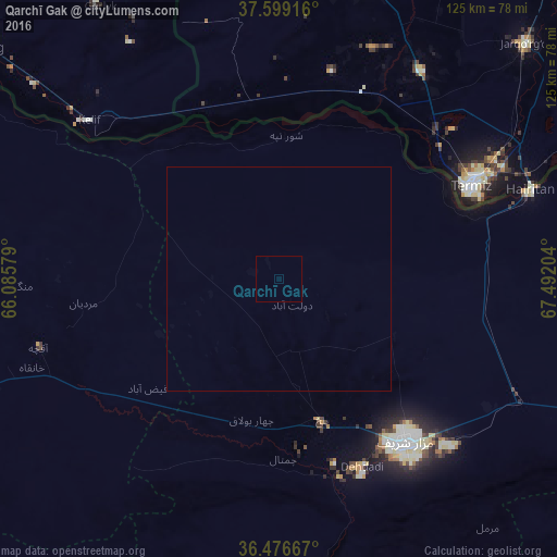
Analysis of Qarchī Gak night lights 2016
Square area 10x10 km:
 0%
0%90-99
0%80-89
0%70-79
0%60-69
0%50-59
0%40-49
0%30-39
0%20-29
0%10-19
0%0-9
100%Square area 50x50 km:
0%90-99
0%80-89
0%70-79
0%60-69
0%50-59
0%40-49
0%30-39
0%20-29
0%10-19
0%0-9
100%Clear (daylight) street map image can be seen on geolist.org.
Map coordinates:
37° 35' 57" North, 66° 5' 8.8" East
37° 2' 24" North, 66° 47' 20.1" East
36° 28' 36" North, 67° 29' 31.3" East
Some cities around Qarchī Gak sort by population:
• Mazār-e Sharīf
46.6 km =29 mi,  142°
142°
• Tirmiz, UZ
48 km =29.8 mi,  64°
64°
• Balkh
33 km =20.5 mi,  163°
163°
• Khulm
89.4 km =55.6 mi,  115°
115°
• Shibirghān
101 km =62.8 mi,  245°
245°
• Sar-e Pul
119.4 km =74.2 mi,  219°
219°
• Gowurdak, TM
108 km =67.1 mi,  322°
322°
• Qarqīn
78.3 km =48.7 mi,  302°
302°
1129636 (p: 8,942)
Sources (retrieved 2019-11-25):
» Earth at Night: Flat Maps 2012, 2016