Whittlesea night lights from space
Night Light of Whittlesea (Eastern Cape) from space (South Africa) Src. Average luminocity for 10x10km area is 11.4983% and for 50x50km: 0.8822%.
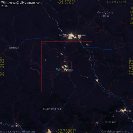
Analysis of Whittlesea night lights 2016
Square area 10x10 km:
 0%
0%90-99
0%80-89
1.05%70-79
3.85%60-69
3.5%50-59
1.75%40-49
1.75%30-39
3.15%20-29
2.97%10-19
0.87%0-9
81.12%Square area 50x50 km:
0%90-99
0%80-89
0.04%70-79
0.2%60-69
0.17%50-59
0.21%40-49
0.26%30-39
0.28%20-29
0.2%10-19
0.09%0-9
98.54%Clear (daylight) street map image can be seen on geolist.org.
Map coordinates:
31° 34' 43.7" South, 26° 7' 16.5" East
32° 10' 33.2" South, 26° 49' 27.7" East
32° 46' 8.7" South, 27° 31' 39" East
Some cities around Whittlesea sort by population:
• Queenstown
31.3 km =19.4 mi,  8°
8°
• Fort Beaufort
68.9 km =42.8 mi,  195°
195°
• Stutterheim
71.4 km =44.4 mi,  127°
127°
• Lady Frere
65.2 km =40.5 mi,  36°
36°
• Queensdale
36.9 km =22.9 mi,  23°
23°
• Adelaide
77.2 km =48 mi,  220°
220°
• Ilinge
30.2 km =18.8 mi, 42°
• Alice
68 km =42.3 mi,  179°
179°
940186 (p: 12,080)
Sources (retrieved 2019-11-25):
» Earth at Night: Flat Maps 2012, 2016