Queenstown night lights from space
Night Light of Queenstown (Eastern Cape) from space (South Africa) Src. Average luminocity for 10x10km area is 31.2546% and for 50x50km: 2.1451%.
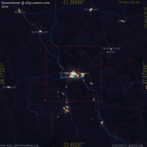
Analysis of Queenstown night lights 2016
Square area 10x10 km:
 4.03%
4.03%90-99
5.49%80-89
3.48%70-79
6.04%60-69
5.86%50-59
1.65%40-49
2.01%30-39
3.3%20-29
4.03%10-19
39.56%0-9
24.54%Square area 50x50 km:
0.16%90-99
0.22%80-89
0.2%70-79
0.49%60-69
0.31%50-59
0.21%40-49
0.33%30-39
0.35%20-29
0.3%10-19
2.07%0-9
95.36%Clear (daylight) street map image can be seen on geolist.org.
Map coordinates:
31° 17' 55.2" South, 26° 10' 20" East
31° 53' 51.2" South, 26° 52' 31.2" East
32° 29' 33.3" South, 27° 34' 42.5" East
Some cities around Queenstown sort by population:
• Fort Beaufort
100.1 km =62.2 mi,  193°
193°
• Stutterheim
90.9 km =56.5 mi,  145°
145°
• Lady Frere
40.1 km =24.9 mi,  57°
57°
• Whittlesea
31.3 km =19.4 mi, 188°
• Ilinge
18.1 km =11.2 mi,  119°
119°
• Molteno
73.9 km =45.9 mi,  318°
318°
• Alice
99 km =61.5 mi,  182°
182°
• Dordrecht
60.7 km =37.7 mi,  15°
15°
963516 (p: 105,309)
Sources (retrieved 2019-11-25):
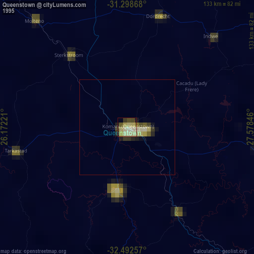
» NASA, Earths city lights 1995
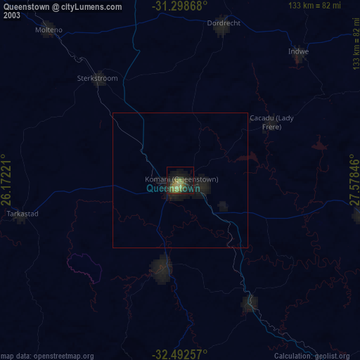
» NASA city lights 2003
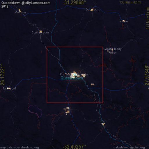
» Earth at Night: Flat Maps 2012, 2016