Prince Albert night lights from space
Night Light of Prince Albert (Western Cape) from space (South Africa) Src. Average luminocity for 10x10km area is 1.3899% and for 50x50km: 0.0566%.
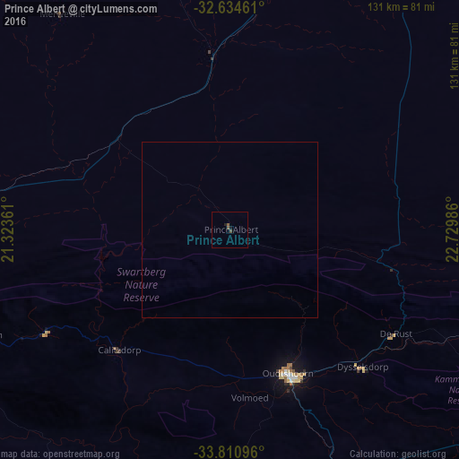
Analysis of Prince Albert night lights 2016
Square area 10x10 km:
 0%
0%90-99
0%80-89
0%70-79
0%60-69
0%50-59
1.4%40-49
0.7%30-39
0%20-29
0.52%10-19
0.87%0-9
96.5%Square area 50x50 km:
0%90-99
0%80-89
0%70-79
0%60-69
0%50-59
0.06%40-49
0.03%30-39
0%20-29
0.02%10-19
0.04%0-9
99.86%Clear (daylight) street map image can be seen on geolist.org.
Map coordinates:
32° 38' 4.6" South, 21° 19' 25" East
33° 13' 29.1" South, 22° 1' 36.2" East
33° 48' 39.5" South, 22° 43' 47.5" East
Some cities around Prince Albert sort by population:
• Knysna
130.6 km =81.2 mi,  133°
133°
• Oudtshoorn
44.7 km =27.8 mi,  158°
158°
• Mossel Bay
107.1 km =66.5 mi,  174°
174°
• Beaufort West
109.6 km =68.1 mi,  28°
28°
• Riversdale
120 km =74.6 mi,  216°
216°
• George
91.4 km =56.8 mi,  153°
153°
• Ladismith
76.6 km =47.6 mi,  247°
247°
• Albertina
116.6 km =72.5 mi,  200°
200°
964078 (p: 13,136)
Sources (retrieved 2019-11-25):
» Earth at Night: Flat Maps 2012, 2016