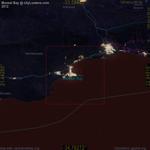
Mossel Bay night lights from space
Night Light of Mossel Bay (Western Cape) from space (South Africa) Src. Average luminocity for 10x10km area is 25.7637% and for 50x50km: 2.9462%.


Analysis of Mossel Bay night lights 2016
Square area 10x10 km:
 4.95%
4.95%90-99
5.86%80-89
3.11%70-79
3.3%60-69
2.38%50-59
2.01%40-49
2.38%30-39
1.28%20-29
3.3%10-19
24.36%0-9
47.07%Square area 50x50 km:
0.25%90-99
0.29%80-89
0.22%70-79
0.32%60-69
0.5%50-59
0.43%40-49
0.45%30-39
0.63%20-29
0.55%10-19
2.81%0-9
93.53%Clear (daylight) street map image can be seen on geolist.org.
Map coordinates:
33° 35' 57.9" South, 21° 26' 34.5" East
34° 10' 59.1" South, 22° 8' 45.8" East
34° 45' 45.8" South, 22° 50' 57" East
Some cities around Mossel Bay sort by population:
• Knysna
84.5 km =52.5 mi,  78°
78°
• Oudtshoorn
65 km =40.4 mi,  4°
4°
• Plettenberg Bay
113.7 km =70.6 mi, 82°
• Riversdale
82.4 km =51.2 mi,  276°
276°
• Prince Albert
107.1 km =66.5 mi,  354°
354°
• George
38 km =23.6 mi,  49°
49°
• Ladismith
111.6 km =69.3 mi,  313°
313°
• Albertina
52.1 km =32.4 mi,  267°
267°
973709 (p: 59,031)
Sources (retrieved 2019-11-25):
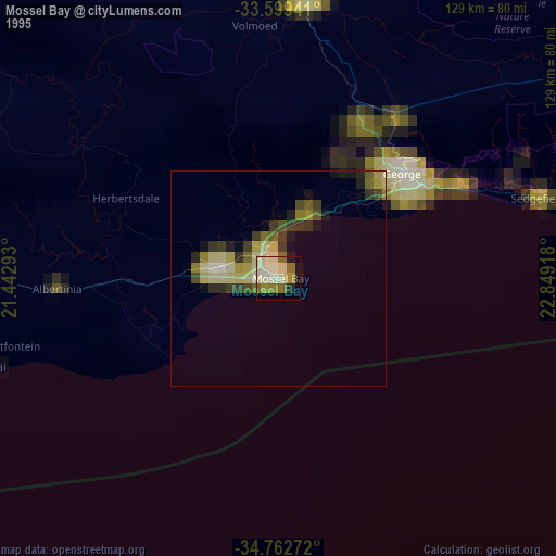
» NASA, Earths city lights 1995
» NASA city lights 2003
» Earth at Night: Flat Maps 2012, 2016