East London night lights from space
Night Light of East London (Eastern Cape) from space (South Africa) Src. Average luminocity for 10x10km area is 63.544% and for 50x50km: 9.6638%.
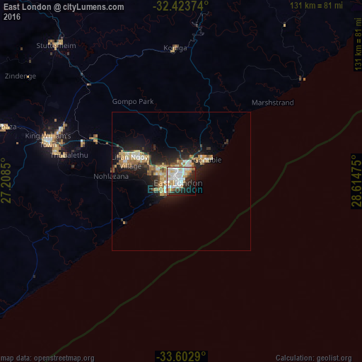
Analysis of East London night lights 2016
Square area 10x10 km:
 20.33%
90-99
20.33%80-89
7.88%70-79
6.59%60-69
4.76%50-59
0%40-49
4.03%30-39
2.38%20-29
17.03%10-19
11.36%0-9
5.31%Square area 50x50 km:
1.31%90-99
1.75%80-89
1.31%70-79
1.67%60-69
1.34%50-59
0.63%40-49
0.82%30-39
1.47%20-29
3.12%10-19
7.14%0-9
79.45%Clear (daylight) street map image can be seen on geolist.org.
Map coordinates:
32° 25' 25.5" South, 27° 12' 30.6" East
33° 0' 55" South, 27° 54' 41.8" East
33° 36' 10.4" South, 28° 36' 53.1" East
Some cities around East London sort by population:
• Bhisho
47.6 km =29.6 mi,  293°
293°
• Grahamstown
132.3 km =82.2 mi,  255°
255°
• Fort Beaufort
122.3 km =76 mi,  282°
282°
• Stutterheim
67.2 km =41.8 mi,  317°
317°
• Butterworth
79.3 km =49.3 mi,  16°
16°
• Port Alfred
114.7 km =71.3 mi,  236°
236°
• Whittlesea
138.1 km =85.8 mi,  312°
312°
• Alice
103.7 km =64.4 mi, 284°
1006984 (p: 478,676)
Sources (retrieved 2019-11-25):
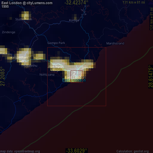
» NASA, Earths city lights 1995
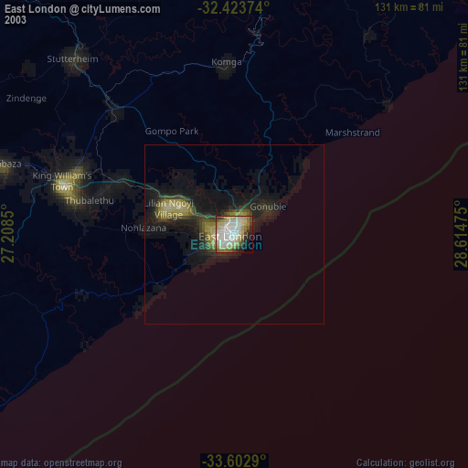
» NASA city lights 2003
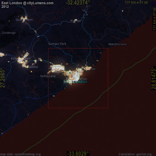
» Earth at Night: Flat Maps 2012, 2016