Butterworth night lights from space
Night Light of Butterworth (Eastern Cape) from space (South Africa) Src. Average luminocity for 10x10km area is 17.1227% and for 50x50km: 1.1305%.
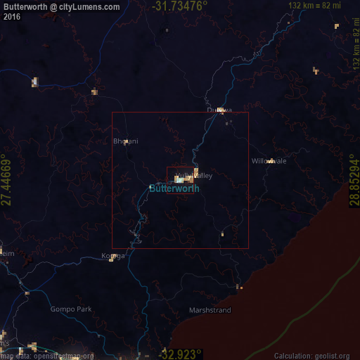
Analysis of Butterworth night lights 2016
Square area 10x10 km:
 2.2%
2.2%90-99
1.47%80-89
3.48%70-79
4.4%60-69
2.38%50-59
0.73%40-49
1.47%30-39
0.73%20-29
0%10-19
10.81%0-9
72.34%Square area 50x50 km:
0.09%90-99
0.06%80-89
0.23%70-79
0.32%60-69
0.13%50-59
0.08%40-49
0.12%30-39
0.07%20-29
0.11%10-19
0.51%0-9
98.28%Clear (daylight) street map image can be seen on geolist.org.
Map coordinates:
31° 44' 5.1" South, 27° 26' 48.1" East
32° 19' 51" South, 28° 8' 59.3" East
32° 55' 22.8" South, 28° 51' 10.6" East
Some cities around Butterworth sort by population:
• East London
79.3 km =49.3 mi,  196°
196°
• Bhisho
87.7 km =54.5 mi,  229°
229°
• Mthatha
101.9 km =63.3 mi,  35°
35°
• Stutterheim
73.1 km =45.4 mi,  248°
248°
• Lady Frere
111.1 km =69 mi,  308°
308°
• Queensdale
121.6 km =75.6 mi,  294°
294°
• Elliot
114.5 km =71.1 mi,  345°
345°
• Ilinge
111.4 km =69.2 mi, 290°
1014489 (p: 34,353)
Sources (retrieved 2019-11-25):
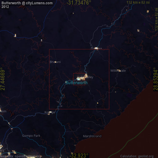
» Earth at Night: Flat Maps 2012, 2016