Bhisho night lights from space
Night Light of Bhisho (Eastern Cape) from space (South Africa) Src. Average luminocity for 10x10km area is 25.4441% and for 50x50km: 4.1874%.
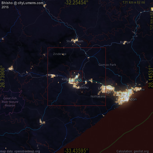
Analysis of Bhisho night lights 2016
Square area 10x10 km:
 2.8%
2.8%90-99
4.02%80-89
2.27%70-79
4.55%60-69
4.37%50-59
2.97%40-49
2.1%30-39
4.72%20-29
5.94%10-19
23.25%0-9
43.01%Square area 50x50 km:
0.25%90-99
0.34%80-89
0.58%70-79
1.07%60-69
0.84%50-59
0.41%40-49
0.27%30-39
0.68%20-29
0.59%10-19
3.61%0-9
91.37%Clear (daylight) street map image can be seen on geolist.org.
Map coordinates:
32° 15' 16.3" South, 26° 44' 20.6" East
32° 50' 50" South, 27° 26' 31.8" East
33° 26' 9.4" South, 28° 8' 43.1" East
Some cities around Bhisho sort by population:
• East London
47.6 km =29.6 mi,  113°
113°
• Grahamstown
98.8 km =61.4 mi,  239°
239°
• Fort Beaufort
76 km =47.2 mi,  276°
276°
• Stutterheim
30.8 km =19.1 mi,  356°
356°
• Butterworth
87.7 km =54.5 mi,  49°
49°
• Port Alfred
97.2 km =60.4 mi,  212°
212°
• Whittlesea
94.5 km =58.7 mi,  322°
322°
• Alice
57.2 km =35.5 mi, 276°
1019330 (p: 137,287)
Sources (retrieved 2019-11-25):
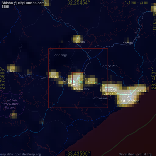
» NASA, Earths city lights 1995
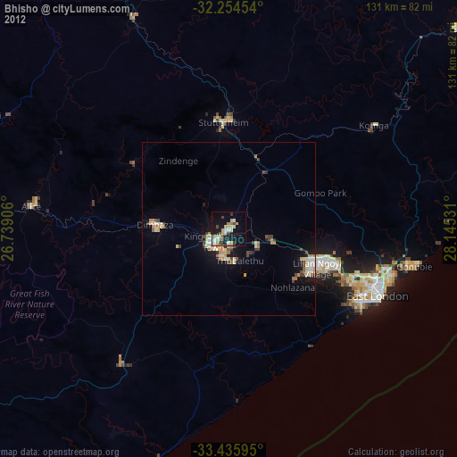
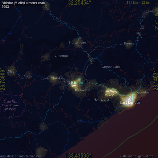
» NASA city lights 2003
» Earth at Night: Flat Maps 2012, 2016