Grahamstown night lights from space
Night Light of Grahamstown (Eastern Cape) from space (South Africa) Src. Average luminocity for 10x10km area is 29.3427% and for 50x50km: 1.3748%.
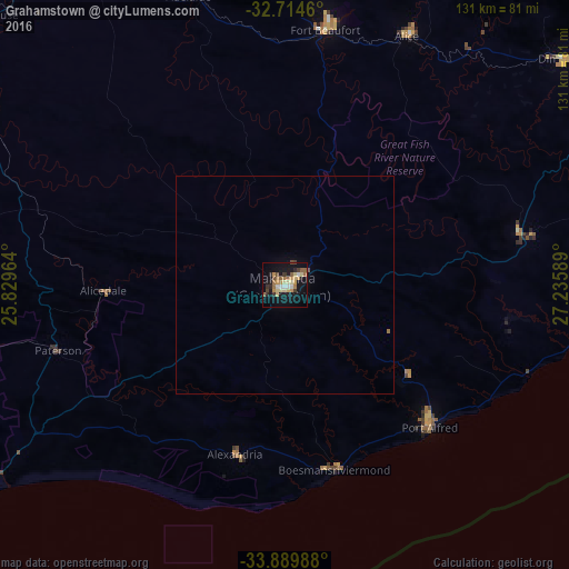
Analysis of Grahamstown night lights 2016
Square area 10x10 km:
 2.27%
2.27%90-99
2.27%80-89
7.17%70-79
5.77%60-69
4.2%50-59
4.55%40-49
2.8%30-39
3.15%20-29
3.5%10-19
31.99%0-9
32.34%Square area 50x50 km:
0.09%90-99
0.09%80-89
0.29%70-79
0.24%60-69
0.2%50-59
0.19%40-49
0.16%30-39
0.13%20-29
0.14%10-19
1.31%0-9
97.15%Clear (daylight) street map image can be seen on geolist.org.
Map coordinates:
32° 42' 52.6" South, 25° 49' 46.7" East
33° 18' 15.2" South, 26° 31' 57.9" East
33° 53' 23.6" South, 27° 14' 9.2" East
Some cities around Grahamstown sort by population:
• Port Elizabeth
112 km =69.6 mi,  229°
229°
• Bhisho
98.8 km =61.4 mi,  59°
59°
• Fort Beaufort
59.6 km =37 mi,  9°
9°
• Port Alfred
45.2 km =28.1 mi,  133°
133°
• Somerset East
109.3 km =67.9 mi,  306°
306°
• Adelaide
69.9 km =43.4 mi,  341°
341°
• Kirkwood
101.8 km =63.3 mi,  264°
264°
• Alice
64 km =39.8 mi,  26°
26°
1000501 (p: 91,548)
Sources (retrieved 2019-11-25):
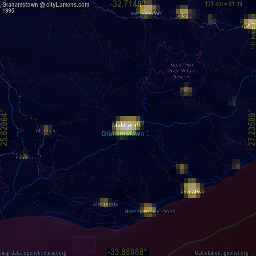
» NASA, Earths city lights 1995
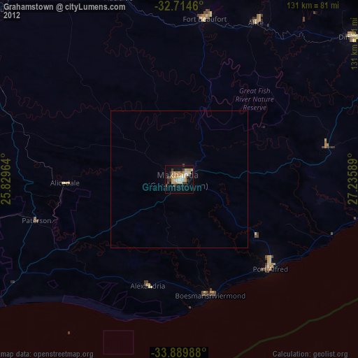
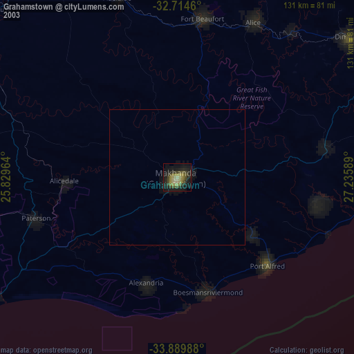
» NASA city lights 2003
» Earth at Night: Flat Maps 2012, 2016