Valera night lights from space
Night Light of Valera (Trujillo) from space (Venezuela) Src. Average luminocity for 10x10km area is 54.2446% and for 50x50km: 9.5127%.
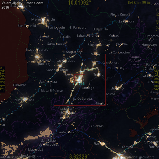
Analysis of Valera night lights 2016
Square area 10x10 km:
 10.82%
90-99
12.55%80-89
6.49%70-79
9.31%60-69
6.71%50-59
3.25%40-49
4.98%30-39
7.36%20-29
25.76%10-19
12.12%0-9
0.65%Square area 50x50 km:
0.74%90-99
1.09%80-89
0.68%70-79
1.33%60-69
1.96%50-59
0.8%40-49
1.5%30-39
2.4%20-29
2.18%10-19
8.6%0-9
78.73%Clear (daylight) street map image can be seen on geolist.org.
Map coordinates:
10° 0' 39.3" North, 71° 18' 24.3" West
9° 19' 4" North, 70° 36' 13" West
8° 37' 23.7" North, 69° 54' 1.8" West
Some cities around Valera sort by population:
• Barinas
88.7 km =55.1 mi,  150°
150°
• Mérida
101.2 km =62.9 mi,  216°
216°
• Alto Barinas
90.6 km =56.3 mi, 152°
• Guanare
99.4 km =61.8 mi,  107°
107°
• Ejido
110.7 km =68.8 mi, 219°
• El Tocuyo
103.1 km =64.1 mi,  59°
59°
• Trujillo
19.1 km =11.9 mi,  73°
73°
• Barinitas
65.3 km =40.6 mi,  161°
161°
3625542 (p: 93,756)
Sources (retrieved 2019-11-25):
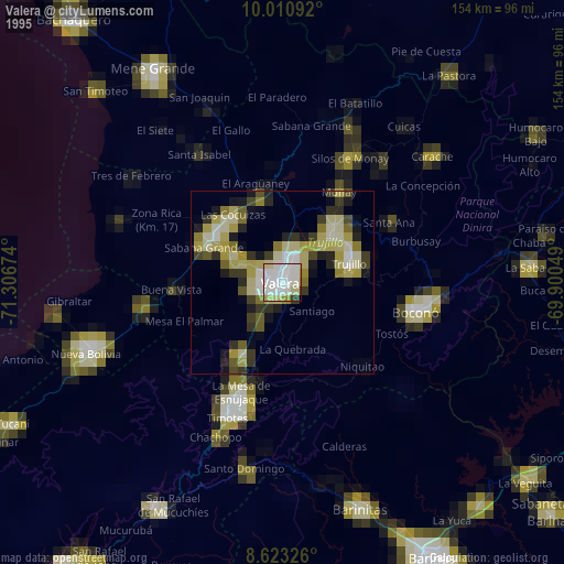
» NASA, Earths city lights 1995
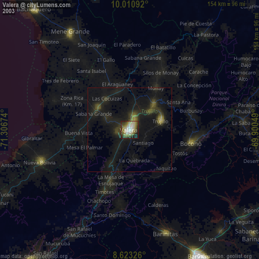
» NASA city lights 2003
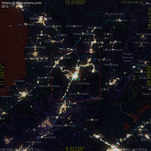
» Earth at Night: Flat Maps 2012, 2016