Alto Barinas night lights from space
Night Light of Alto Barinas (Barinas) from space (Venezuela) Src. Average luminocity for 10x10km area is 59.3492% and for 50x50km: 8.3524%.
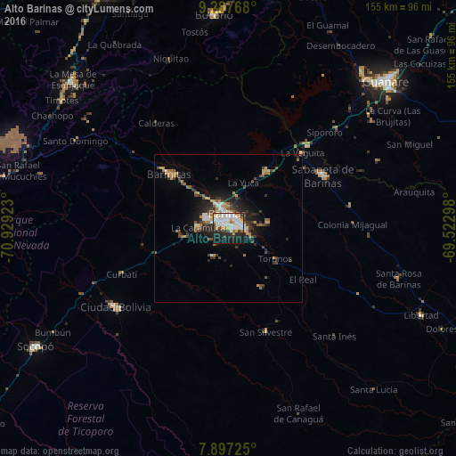
Analysis of Alto Barinas night lights 2016
Square area 10x10 km:
 20.04%
90-99
17.77%80-89
3.1%70-79
5.79%60-69
5.99%50-59
1.65%40-49
3.93%30-39
5.99%20-29
14.88%10-19
19.83%0-9
1.03%Square area 50x50 km:
1.19%90-99
1.22%80-89
0.36%70-79
1.46%60-69
1.15%50-59
0.82%40-49
1.3%30-39
1.89%20-29
2.71%10-19
4.84%0-9
83.04%Clear (daylight) street map image can be seen on geolist.org.
Map coordinates:
9° 17' 15.6" North, 70° 55' 45.2" West
8° 35' 35.2" North, 70° 13' 34" West
7° 53' 50.1" North, 69° 31' 22.7" West
Some cities around Alto Barinas sort by population:
• Barinas
3.9 km =2.4 mi,  31°
31°
• Mérida
102.2 km =63.5 mi,  269°
269°
• Mucumpiz
101.7 km =63.2 mi,  258°
258°
• Guanare
72.9 km =45.3 mi,  46°
46°
• Ejido
111.7 km =69.4 mi, 267°
• Valera
90.6 km =56.3 mi,  332°
332°
• Trujillo
89 km =55.3 mi,  344°
344°
• Barinitas
27.7 km =17.2 mi,  312°
312°
3487903 (p: 284,289)
Sources (retrieved 2019-11-25):
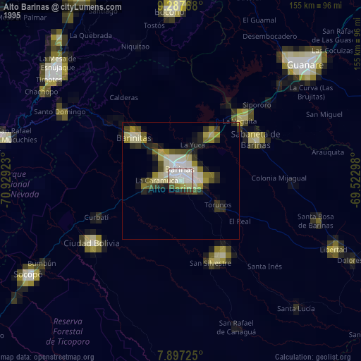
» NASA, Earths city lights 1995
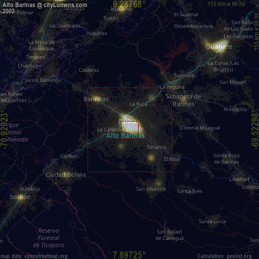
» NASA city lights 2003
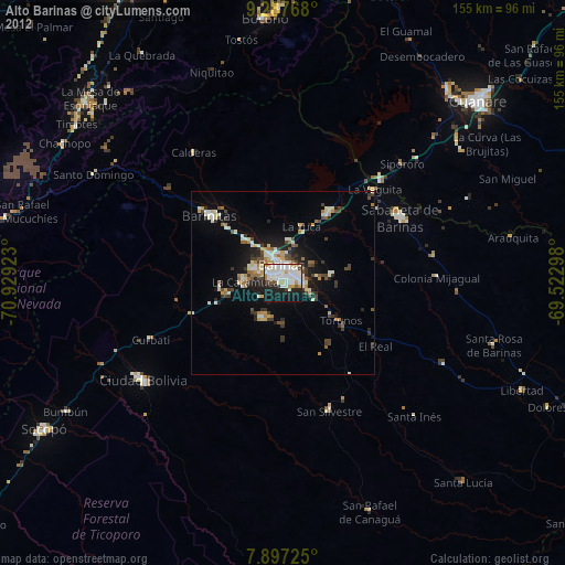
» Earth at Night: Flat Maps 2012, 2016