San Felipe night lights from space
Night Light of San Felipe (Yaracuy) from space (Venezuela) Src. Average luminocity for 10x10km area is 48.6963% and for 50x50km: 6.4443%.
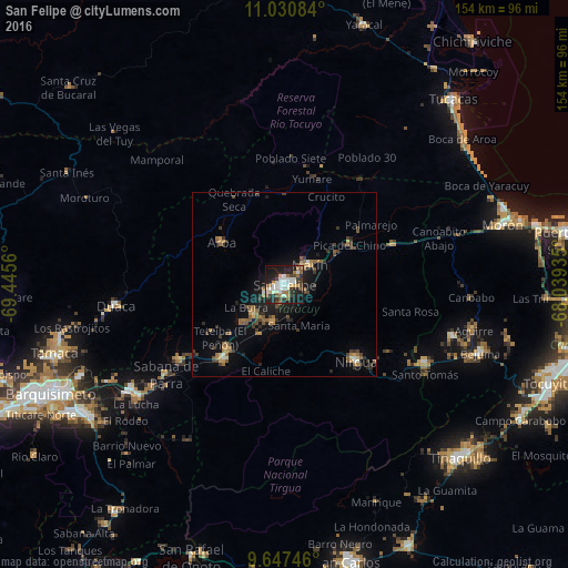
Analysis of San Felipe night lights 2016
Square area 10x10 km:
 11.36%
90-99
10.74%80-89
3.1%70-79
6.61%60-69
6.2%50-59
3.51%40-49
5.37%30-39
9.5%20-29
15.7%10-19
26.03%0-9
1.86%Square area 50x50 km:
0.54%90-99
0.63%80-89
0.33%70-79
0.88%60-69
1.22%50-59
1.14%40-49
1.01%30-39
1.6%20-29
1.47%10-19
4.86%0-9
86.33%Clear (daylight) street map image can be seen on geolist.org.
Map coordinates:
11° 1' 51" North, 69° 26' 44.2" West
10° 20' 23.7" North, 68° 44' 32.9" West
9° 38' 50.9" North, 68° 2' 21.7" West
Some cities around San Felipe sort by population:
• Barquisimeto
73.9 km =45.9 mi,  245°
245°
• Yaritagua
50.7 km =31.5 mi,  235°
235°
• Tinaquillo
67 km =41.6 mi,  134°
134°
• Chivacoa
26.1 km =16.2 mi,  219°
219°
• Morón
61.5 km =38.2 mi,  74°
74°
• Los Rastrojos
64.8 km =40.3 mi, 237°
• Nirgua
28.7 km =17.8 mi,  137°
137°
• Tucacas
67.7 km =42.1 mi,  42°
42°
3628423 (p: 76,766)
Sources (retrieved 2019-11-25):
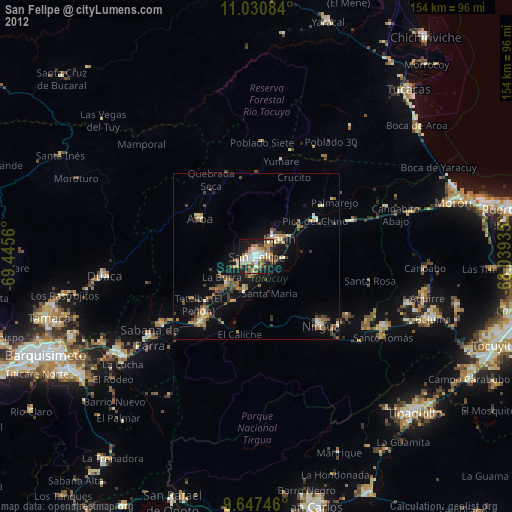
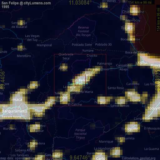
» NASA, Earths city lights 1995
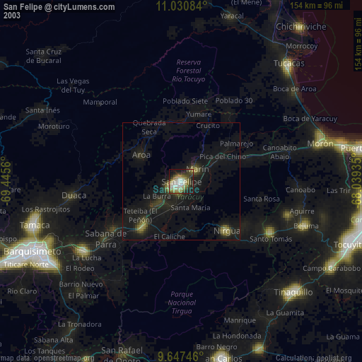
» NASA city lights 2003
» Earth at Night: Flat Maps 2012, 2016