Tinaquillo night lights from space
Night Light of Tinaquillo (Cojedes) from space (Venezuela) Src. Average luminocity for 10x10km area is 52.0041% and for 50x50km: 8.8464%.
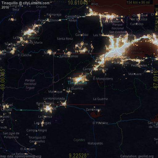
Analysis of Tinaquillo night lights 2016
Square area 10x10 km:
 5.99%
5.99%90-99
7.44%80-89
4.55%70-79
16.94%60-69
10.12%50-59
7.85%40-49
5.58%30-39
6.4%20-29
16.53%10-19
17.77%0-9
0.83%Square area 50x50 km:
0.91%90-99
1.09%80-89
0.62%70-79
1.81%60-69
1.75%50-59
0.96%40-49
1.01%30-39
1.5%20-29
2.49%10-19
6.1%0-9
81.75%Clear (daylight) street map image can be seen on geolist.org.
Map coordinates:
10° 36' 37.7" North, 69° 0' 28.3" West
9° 55' 7" North, 68° 18' 17" West
9° 13' 31" North, 67° 36' 5.8" West
Some cities around Tinaquillo sort by population:
• Valencia
42.3 km =26.3 mi,  50°
50°
• Guacara
58 km =36 mi, 53°
• San Carlos
41.8 km =26 mi,  226°
226°
• San Felipe
67 km =41.6 mi,  314°
314°
• Güigüe
60.5 km =37.6 mi,  72°
72°
• Morón
64.2 km =39.9 mi,  10°
10°
• Tacarigua
46.1 km =28.6 mi, 66°
• Nirgua
38.4 km =23.9 mi, 312°
3626219 (p: 82,145)
Sources (retrieved 2019-11-25):
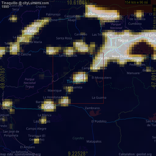
» NASA, Earths city lights 1995
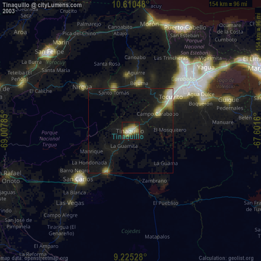
» NASA city lights 2003
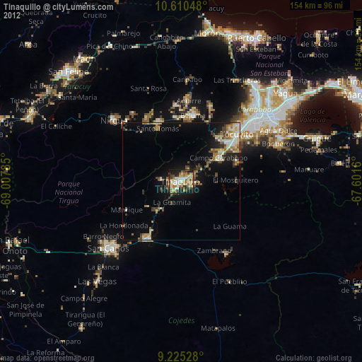
» Earth at Night: Flat Maps 2012, 2016