Nirgua night lights from space
Night Light of Nirgua (Yaracuy) from space (Venezuela) Src. Average luminocity for 10x10km area is 15.0083% and for 50x50km: 4.6157%.
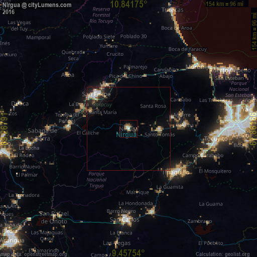
Analysis of Nirgua night lights 2016
Square area 10x10 km:
 1.03%
1.03%90-99
1.45%80-89
1.65%70-79
1.65%60-69
3.51%50-59
1.86%40-49
2.48%30-39
5.58%20-29
2.69%10-19
0.83%0-9
77.27%Square area 50x50 km:
0.56%90-99
0.54%80-89
0.29%70-79
0.66%60-69
0.72%50-59
0.51%40-49
0.74%30-39
1.01%20-29
1.05%10-19
3.31%0-9
90.61%Clear (daylight) street map image can be seen on geolist.org.
Map coordinates:
10° 50' 30.3" North, 69° 16' 4.5" West
10° 9' 1.4" North, 68° 33' 53.2" West
9° 27' 27.1" North, 67° 51' 42" West
Some cities around Nirgua sort by population:
• Valencia
61 km =37.9 mi,  88°
88°
• Puerto Cabello
70.3 km =43.7 mi,  59°
59°
• Yaritagua
61.7 km =38.3 mi,  262°
262°
• Tinaquillo
38.4 km =23.9 mi,  132°
132°
• San Carlos
54.4 km =33.8 mi,  182°
182°
• San Felipe
28.7 km =17.8 mi,  317°
317°
• Chivacoa
36.1 km =22.4 mi,  271°
271°
• Morón
54.7 km =34 mi,  46°
46°
3631507 (p: 30,188)
Sources (retrieved 2019-11-25):
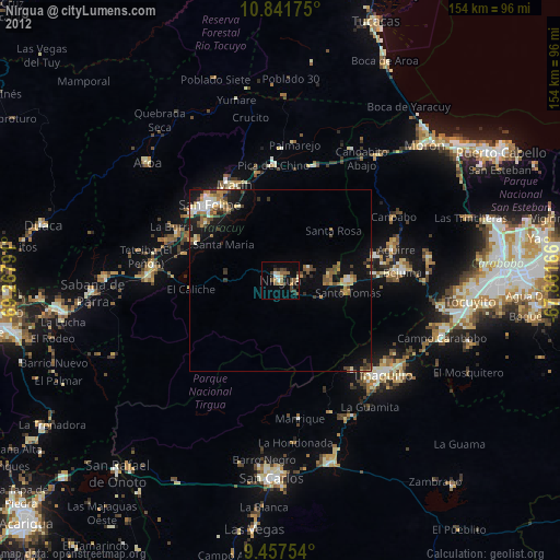
» Earth at Night: Flat Maps 2012, 2016