Los Rastrojos night lights from space
Night Light of Los Rastrojos (Lara) from space (Venezuela) Src. Average luminocity for 10x10km area is 56.8678% and for 50x50km: 17.576%.
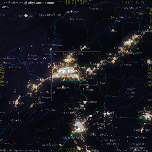
Analysis of Los Rastrojos night lights 2016
Square area 10x10 km:
 9.5%
9.5%90-99
14.05%80-89
2.89%70-79
5.99%60-69
13.84%50-59
8.47%40-49
8.06%30-39
16.94%20-29
11.36%10-19
8.88%0-9
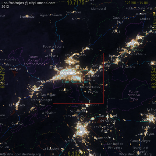
0%Square area 50x50 km:
2.64%90-99
2.98%80-89
1.21%70-79
2.87%60-69
4.23%50-59
1.53%40-49
1.74%30-39
3.82%20-29
4.23%10-19
9.97%0-9
64.76%Clear (daylight) street map image can be seen on geolist.org.
Map coordinates:
10° 43' 3" North, 69° 56' 41.2" West
10° 1' 33.2" North, 69° 14' 30" West
9° 19' 58" North, 68° 32' 18.7" West
Some cities around Los Rastrojos sort by population:
• Barquisimeto
13.3 km =8.3 mi,  288°
288°
• Acarigua
52.7 km =32.7 mi,  174°
174°
• Yaritagua
14.2 km =8.8 mi,  64°
64°
• San Felipe
64.8 km =40.3 mi, 57°
• Araure
49.4 km =30.7 mi,  179°
179°
• El Tocuyo
66 km =41 mi,  246°
246°
• Chivacoa
40.8 km =25.4 mi,  68°
68°
• Quíbor
42.8 km =26.6 mi,  255°
255°
3633677 (p: 34,636)
Sources (retrieved 2019-11-25):
» Earth at Night: Flat Maps 2012, 2016