Morón night lights from space
Night Light of Morón (Carabobo) from space (Venezuela) Src. Average luminocity for 10x10km area is 36.5496% and for 50x50km: 8.5721%.
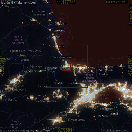
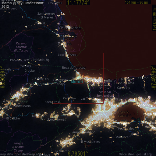
Analysis of Morón night lights 2016
Square area 10x10 km:
 4.75%
4.75%90-99
5.37%80-89
1.65%70-79
12.4%60-69
4.75%50-59
6.2%40-49
0.83%30-39
2.69%20-29
4.55%10-19
43.39%0-9
13.43%Square area 50x50 km:
0.84%90-99
0.94%80-89
0.44%70-79
1.98%60-69
1.36%50-59
1.51%40-49
0.78%30-39
0.99%20-29
2.37%10-19
8.11%0-9
80.67%Clear (daylight) street map image can be seen on geolist.org.
Map coordinates:
11° 10' 39.9" North, 68° 54' 14.1" West
10° 29' 13.7" North, 68° 12' 2.8" West
9° 47' 42" North, 67° 29' 51.6" West
Some cities around Morón sort by population:
• Valencia
41.9 km =26 mi,  149°
149°
• Puerto Cabello
20.6 km =12.8 mi,  94°
94°
• Guacara
45.8 km =28.5 mi,  129°
129°
• San Joaquín
51.2 km =31.8 mi,  119°
119°
• Tacarigua
54.1 km =33.6 mi, 145°
• Nirgua
54.7 km =34 mi,  226°
226°
• Chichiriviche
49.7 km =30.9 mi,  350°
350°
• Tucacas
36.3 km =22.6 mi,  337°
337°
3631878 (p: 44,308)
Sources (retrieved 2019-11-25):
» Earth at Night: Flat Maps 2012, 2016