San Carlos night lights from space
Night Light of San Carlos (Cojedes) from space (Venezuela) Src. Average luminocity for 10x10km area is 43.9177% and for 50x50km: 3.8425%.
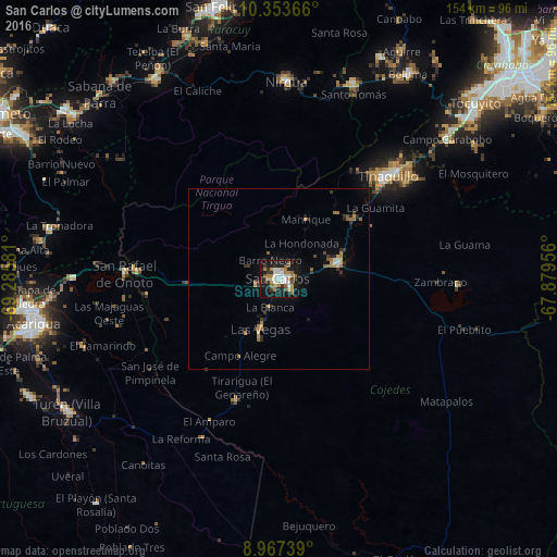
Analysis of San Carlos night lights 2016
Square area 10x10 km:
 7.58%
7.58%90-99
8.87%80-89
3.25%70-79
5.41%60-69
9.09%50-59
6.49%40-49
3.25%30-39
7.58%20-29
8.44%10-19
36.36%0-9
3.68%Square area 50x50 km:
0.34%90-99
0.44%80-89
0.17%70-79
0.64%60-69
0.8%50-59
0.53%40-49
0.26%30-39
0.88%20-29
0.73%10-19
2.91%0-9
92.31%Clear (daylight) street map image can be seen on geolist.org.
Map coordinates:
10° 21' 13.2" North, 69° 17' 8.9" West
9° 39' 40.5" North, 68° 34' 57.6" West
8° 58' 2.6" North, 67° 52' 46.4" West
Some cities around San Carlos sort by population:
• Acarigua
68.2 km =42.4 mi,  259°
259°
• Yaritagua
75.5 km =46.9 mi,  308°
308°
• Tinaquillo
41.8 km =26 mi,  46°
46°
• San Felipe
77.5 km =48.2 mi,  346°
346°
• Araure
72.4 km =45 mi, 262°
• Chivacoa
65.1 km =40.5 mi,  328°
328°
• Nirgua
54.4 km =33.8 mi,  2°
2°
• Villa Bruzual
69.3 km =43.1 mi,  238°
238°
3628503 (p: 77,192)
Sources (retrieved 2019-11-25):
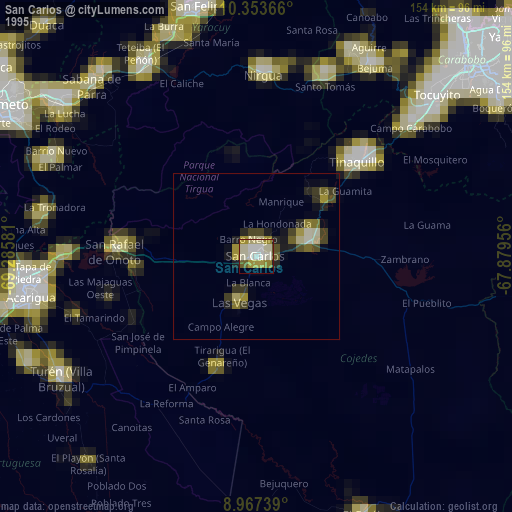
» NASA, Earths city lights 1995
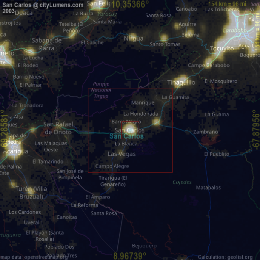
» NASA city lights 2003
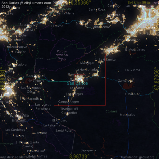
» Earth at Night: Flat Maps 2012, 2016