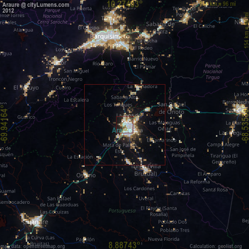
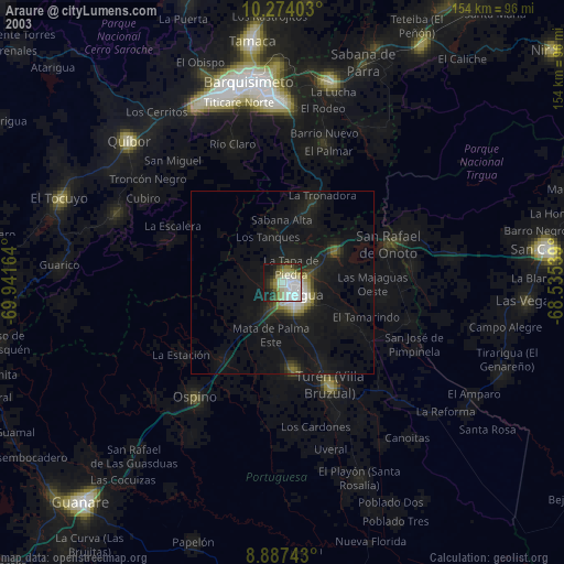
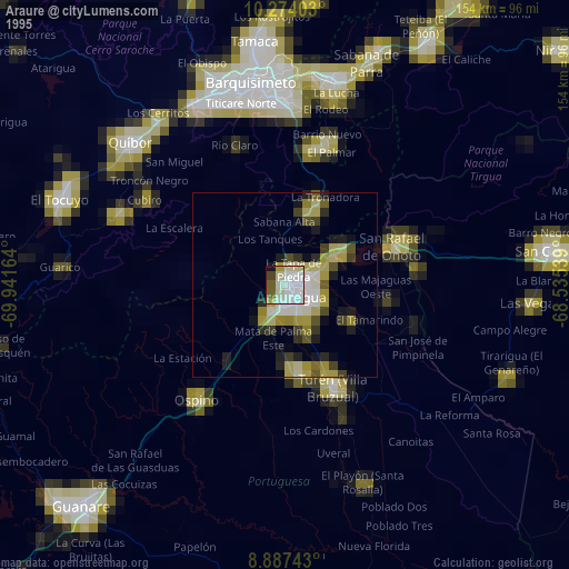
Araure night lights from space
Night Light of Araure (Portuguesa) from space (Venezuela) Src. Average luminocity for 10x10km area is 55.5303% and for 50x50km: 8.6848%.
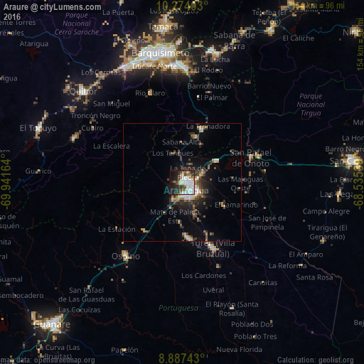
Analysis of Araure night lights 2016
Square area 10x10 km:
 17.32%
90-99
14.72%80-89
2.6%70-79
3.9%60-69
7.79%50-59
3.03%40-49
7.58%30-39
8.01%20-29
14.07%10-19
17.75%0-9
3.25%Square area 50x50 km:
1.3%90-99
1.21%80-89
0.48%70-79
0.82%60-69
1.58%50-59
0.93%40-49
1.64%30-39
2.06%20-29
2.56%10-19
4.56%0-9
82.85%Clear (daylight) street map image can be seen on geolist.org.
Map coordinates:
10° 16' 26.5" North, 69° 56' 29.9" West
9° 34' 53.2" North, 69° 14' 18.6" West
8° 53' 14.7" North, 68° 32' 7.4" West
Some cities around Araure sort by population:
• Barquisimeto
55.3 km =34.4 mi,  346°
346°
• Acarigua
5.6 km =3.5 mi,  122°
122°
• Yaritagua
56.9 km =35.4 mi,  12°
12°
• San Carlos
72.4 km =45 mi,  82°
82°
• El Tocuyo
64.9 km =40.3 mi,  290°
290°
• Quíbor
56.9 km =35.4 mi,  312°
312°
• Los Rastrojos
49.4 km =30.7 mi,  359°
359°
• Villa Bruzual
30.7 km =19.1 mi,  154°
154°
3649017 (p: 73,054)
Sources (retrieved 2019-11-25):
» NASA, Earths city lights 1995
» NASA city lights 2003
» Earth at Night: Flat Maps 2012, 2016