Puerto Cabello night lights from space
Night Light of Puerto Cabello (Carabobo) from space (Venezuela) Src. Average luminocity for 10x10km area is 45.4256% and for 50x50km: 11.929%.
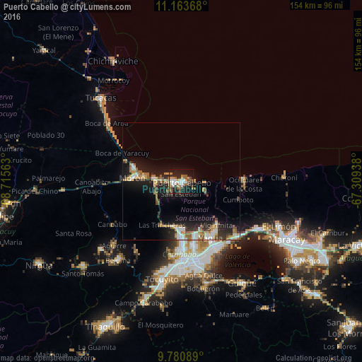
Analysis of Puerto Cabello night lights 2016
Square area 10x10 km:
 8.68%
8.68%90-99
9.09%80-89
2.27%70-79
4.13%60-69
10.54%50-59
9.09%40-49
4.13%30-39
2.48%20-29
14.67%10-19
31.61%0-9
3.31%Square area 50x50 km:
1.59%90-99
1.77%80-89
0.75%70-79
2.12%60-69
1.84%50-59
1.94%40-49
1.16%30-39
1.53%20-29
3.57%10-19
9.81%0-9
73.91%Clear (daylight) street map image can be seen on geolist.org.
Map coordinates:
11° 9' 49.2" North, 68° 42' 56.3" West
10° 28' 23" North, 68° 0' 45" West
9° 46' 51.2" North, 67° 18' 33.8" West
Some cities around Puerto Cabello sort by population:
• Valencia
34.6 km =21.5 mi,  179°
179°
• Guacara
31.2 km =19.4 mi,  151°
151°
• El Limón
45.6 km =28.3 mi,  114°
114°
• Mariara
37.8 km =23.5 mi,  121°
121°
• Morón
20.6 km =12.8 mi,  274°
274°
• San Joaquín
33.6 km =20.9 mi,  134°
134°
• Tacarigua
44.2 km =27.5 mi,  166°
166°
• Tucacas
49.1 km =30.5 mi,  315°
315°
3629706 (p: 174,000)
Sources (retrieved 2019-11-25):
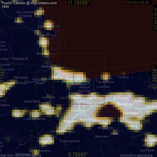
» NASA, Earths city lights 1995
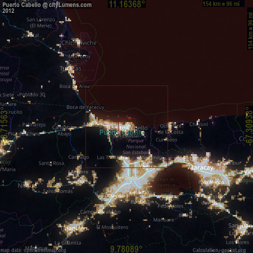
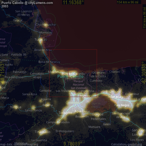
» NASA city lights 2003
» Earth at Night: Flat Maps 2012, 2016