Carora night lights from space
Night Light of Carora (Lara) from space (Venezuela) Src. Average luminocity for 10x10km area is 27.4979% and for 50x50km: 1.4468%.
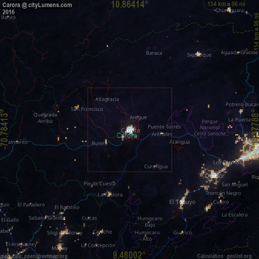
Analysis of Carora night lights 2016
Square area 10x10 km:
 7.23%
7.23%90-99
6.82%80-89
0.83%70-79
1.03%60-69
3.51%50-59
0.41%40-49
1.03%30-39
5.99%20-29
4.13%10-19
29.34%0-9
39.67%Square area 50x50 km:
0.29%90-99
0.28%80-89
0.03%70-79
0.08%60-69
0.29%50-59
0.02%40-49
0.05%30-39
0.32%20-29
0.29%10-19
1.2%0-9
97.15%Clear (daylight) street map image can be seen on geolist.org.
Map coordinates:
10° 51' 50.9" North, 70° 47' 2.9" West
10° 10' 22.2" North, 70° 4' 51.6" West
9° 28' 48.1" North, 69° 22' 40.4" West
Some cities around Carora sort by population:
• Barquisimeto
80.2 km =49.8 mi,  98°
98°
• Valera
111 km =69 mi,  211°
211°
• Yaritagua
105.2 km =65.4 mi, 95°
• Araure
113.3 km =70.4 mi,  125°
125°
• El Tocuyo
53.2 km =33.1 mi,  143°
143°
• Quíbor
57.3 km =35.6 mi,  118°
118°
• Trujillo
97.8 km =60.8 mi,  203°
203°
• Los Rastrojos
93.3 km =58 mi, 100°
3646487 (p: 93,788)
Sources (retrieved 2019-11-25):
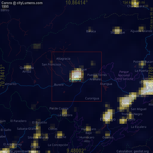
» NASA, Earths city lights 1995
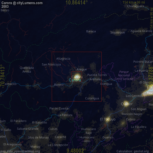
» NASA city lights 2003
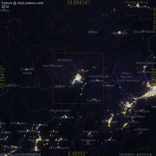
» Earth at Night: Flat Maps 2012, 2016