Nishon Tumani night lights from space
Night Light of Nishon Tumani (Qashqadaryo) from space (Uzbekistan) Src. Average luminocity for 10x10km area is 4.9932% and for 50x50km: 10.0089%.
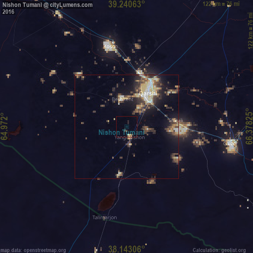
Analysis of Nishon Tumani night lights 2016
Square area 10x10 km:
 0%
0%90-99
0%80-89
1.36%70-79
0.68%60-69
1.02%50-59
0%40-49
0.34%30-39
1.36%20-29
1.87%10-19
0.85%0-9
92.52%Square area 50x50 km:
0.72%90-99
1.4%80-89
1.87%70-79
0.92%60-69
0.92%50-59
1.42%40-49
2.13%30-39
2.84%20-29
2.65%10-19
5.77%0-9
79.34%Clear (daylight) street map image can be seen on geolist.org.
Map coordinates:
39° 14' 26.3" North, 64° 58' 19.2" East
38° 41' 38.2" North, 65° 40' 30.4" East
38° 8' 35" North, 66° 22' 41.7" East
Some cities around Nishon Tumani sort by population:
• Qarshi
21 km =13 mi,  28°
28°
• Koson
39 km =24.2 mi,  348°
348°
• Gowurdak, TM
103.2 km =64.1 mi,  161°
161°
• Atamyrat, TM
103.7 km =64.4 mi,  203°
203°
• Muborak
77 km =47.8 mi,  324°
324°
• G‘uzor
50.4 km =31.3 mi,  99°
99°
• Chiroqchi
86.4 km =53.7 mi,  64°
64°
• Beshkent
14.3 km =8.9 mi, 352°
1215736 (p: 10,558)
Sources (retrieved 2019-11-25):
» Earth at Night: Flat Maps 2012, 2016