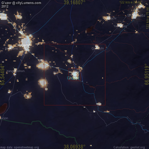
G‘uzor night lights from space
Night Light of G‘uzor (Qashqadaryo) from space (Uzbekistan) Src. Average luminocity for 10x10km area is 35.7695% and for 50x50km: 5.185%.
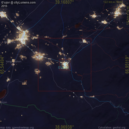
Analysis of G‘uzor night lights 2016
Square area 10x10 km:
 3.41%
3.41%90-99
6.33%80-89
7.47%70-79
2.92%60-69
5.19%50-59
4.06%40-49
6.66%30-39
4.06%20-29
7.79%10-19
36.69%0-9
15.42%Square area 50x50 km:
0.33%90-99
0.56%80-89
0.68%70-79
0.44%60-69
0.62%50-59
0.81%40-49
1.07%30-39
1.53%20-29
1.08%10-19
4.39%0-9
88.47%Clear (daylight) street map image can be seen on geolist.org.
Map coordinates:
39° 10' 5.1" North, 65° 32' 41.8" East
38° 37' 15" North, 66° 14' 53" East
38° 4' 9.8" North, 66° 57' 4.3" East
Some cities around G‘uzor sort by population:
• Qarshi
47.9 km =29.8 mi,  303°
303°
• Koson
73.8 km =45.9 mi,  308°
308°
• Shahrisabz
70.3 km =43.7 mi,  46°
46°
• Kitob
78.4 km =48.7 mi,  44°
44°
• Gowurdak, TM
91.6 km =56.9 mi,  191°
191°
• Chiroqchi
53.8 km =33.4 mi,  31°
31°
• Beshkent
56.2 km =34.9 mi,  293°
293°
• Nishon Tumani
50.4 km =31.3 mi,  279°
279°
1217262 (p: 25,368)
Sources (retrieved 2019-11-25):
» Earth at Night: Flat Maps 2012, 2016