Chiroqchi night lights from space
Night Light of Chiroqchi (Qashqadaryo) from space (Uzbekistan) Src. Average luminocity for 10x10km area is 15.3523% and for 50x50km: 3.911%.
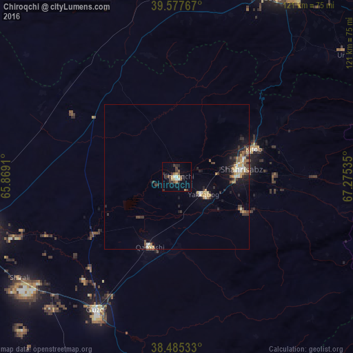
Analysis of Chiroqchi night lights 2016
Square area 10x10 km:
 0.32%
0.32%90-99
2.27%80-89
0.65%70-79
3.9%60-69
0.97%50-59
1.3%40-49
3.73%30-39
4.87%20-29
4.06%10-19
2.27%0-9
75.65%Square area 50x50 km:
0.21%90-99
0.48%80-89
0.48%70-79
0.71%60-69
0.45%50-59
0.45%40-49
0.58%30-39
1.03%20-29
0.9%10-19
2.2%0-9
92.51%Clear (daylight) street map image can be seen on geolist.org.
Map coordinates:
39° 34' 39.6" North, 65° 52' 8.8" East
39° 2' 1" North, 66° 34' 20" East
38° 29' 7.2" North, 67° 16' 31.3" East
Some cities around Chiroqchi sort by population:
• Samarkand
76.6 km =47.6 mi,  25°
25°
• Qarshi
70.4 km =43.7 mi,  254°
254°
• Shahrisabz
22.8 km =14.2 mi,  83°
83°
• Urgut
70.8 km =44 mi,  54°
54°
• Kitob
28.8 km =17.9 mi,  70°
70°
• G‘uzor
53.8 km =33.4 mi,  211°
211°
• Juma
76.3 km =47.4 mi,  5°
5°
• Charxin
75.6 km =47 mi, 12°
1217540 (p: 19,356)
Sources (retrieved 2019-11-25):
» Earth at Night: Flat Maps 2012, 2016