West Coon Rapids night lights from space
Night Light of West Coon Rapids (Minnesota) from space (United States) Src. Average luminocity for 10x10km area is 81.0879% and for 50x50km: 43.2071%.
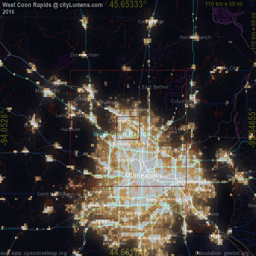
Analysis of West Coon Rapids night lights 2016
Square area 10x10 km:
 18.33%
90-99
18.64%80-89
12.88%70-79
22.58%60-69
20.45%50-59
6.06%40-49
0.61%30-39
0.45%20-29
0%10-19
0%0-9
0%Square area 50x50 km:
12.48%90-99
9.34%80-89
4.82%70-79
5.38%60-69
6.11%50-59
4.69%40-49
4.53%30-39
3.3%20-29
6.11%10-19
11.75%0-9
31.49%Clear (daylight) street map image can be seen on geolist.org.
Map coordinates:
45° 39' 12" North, 94° 3' 10.1" West
45° 9' 34.9" North, 93° 20' 58.8" West
44° 39' 42.3" North, 92° 38' 47.6" West
Some cities around West Coon Rapids sort by population:
• Brooklyn Park
7.3 km =4.5 mi,  184°
184°
• Coon Rapids
6.6 km =4.1 mi,  132°
132°
• Blaine
9 km =5.6 mi,  89°
89°
• Andover
9.4 km =5.8 mi,  29°
29°
• Brooklyn Center
9.4 km =5.8 mi,  171°
171°
• Champlin
5 km =3.1 mi,  310°
310°
• Anoka
5.2 km =3.2 mi,  325°
325°
• Spring Lake Park
10.5 km =6.5 mi,  123°
123°
5052361 (p: 62,528)
Sources (retrieved 2019-11-25):
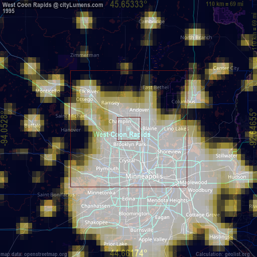
» NASA, Earths city lights 1995
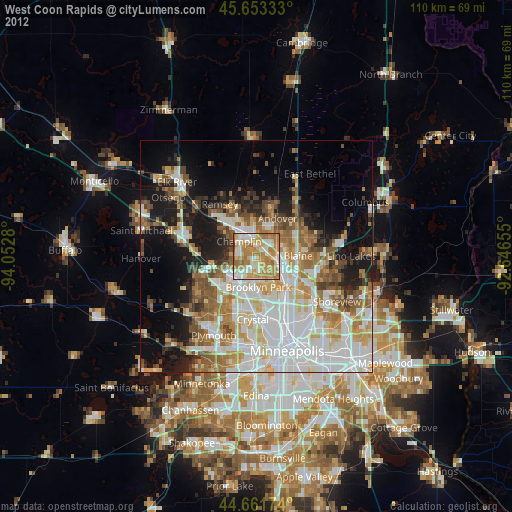
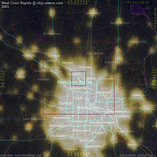
» NASA city lights 2003
» Earth at Night: Flat Maps 2012, 2016