Brooklyn Park night lights from space
Night Light of Brooklyn Park (Minnesota) from space (United States) Src. Average luminocity for 10x10km area is 90.2667% and for 50x50km: 53.3203%.
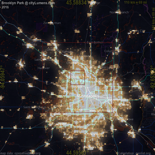
Analysis of Brooklyn Park night lights 2016
Square area 10x10 km:
 31.21%
90-99
29.7%80-89
15.45%70-79
17.27%60-69
6.06%50-59
0.3%40-49
0%30-39
0%20-29
0%10-19
0%0-9
0%Square area 50x50 km:
15.45%90-99
12.3%80-89
6.08%70-79
6.85%60-69
7.7%50-59
6.05%40-49
5.08%30-39
3.55%20-29
6.43%10-19
12.09%0-9
18.41%Clear (daylight) street map image can be seen on geolist.org.
Map coordinates:
45° 35' 18" North, 94° 3' 34.1" West
45° 5' 38.9" North, 93° 21' 22.8" West
44° 35' 44.2" North, 92° 39' 11.6" West
Some cities around Brooklyn Park sort by population:
• Maple Grove
8.2 km =5.1 mi,  252°
252°
• West Coon Rapids
7.3 km =4.5 mi,  4°
4°
• Coon Rapids
6.1 km =3.8 mi,  61°
61°
• Fridley
7.4 km =4.6 mi,  96°
96°
• Crystal
6.8 km =4.2 mi,  182°
182°
• New Hope
6.7 km =4.2 mi,  200°
200°
• Robbinsdale
7 km =4.3 mi,  168°
168°
• Spring Lake Park
9.4 km =5.8 mi,  80°
80°
5019335 (p: 79,149)
Sources (retrieved 2019-11-25):
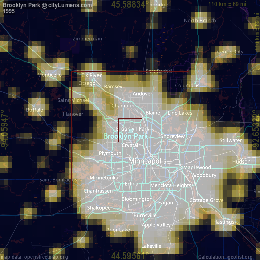
» NASA, Earths city lights 1995
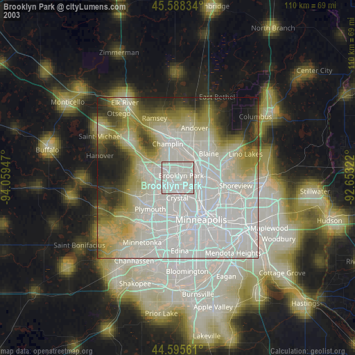
» NASA city lights 2003
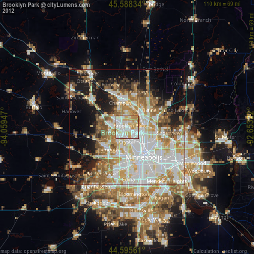
» Earth at Night: Flat Maps 2012, 2016