Blaine night lights from space
Night Light of Blaine (Minnesota) from space (United States) Src. Average luminocity for 10x10km area is 71.3591% and for 50x50km: 45.3755%.
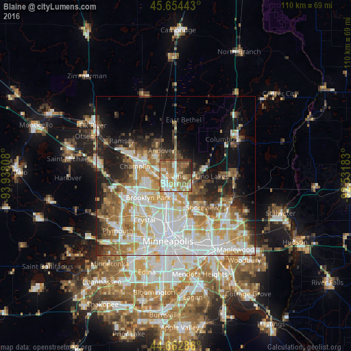
Analysis of Blaine night lights 2016
Square area 10x10 km:
 14.55%
90-99
13.18%80-89
8.33%70-79
9.09%60-69
22.73%50-59
18.64%40-49
7.42%30-39
3.33%20-29
2.73%10-19
0%0-9
0%Square area 50x50 km:
13.17%90-99
10.15%80-89
5.08%70-79
5.81%60-69
6.72%50-59
4.97%40-49
4.58%30-39
3.4%20-29
5.83%10-19
9.63%0-9
30.66%Clear (daylight) street map image can be seen on geolist.org.
Map coordinates:
45° 39' 15.9" North, 93° 56' 17.1" West
45° 9' 38.9" North, 93° 14' 5.8" West
44° 39' 46.3" North, 92° 31' 54.6" West
Some cities around Blaine sort by population:
• West Coon Rapids
9 km =5.6 mi,  269°
269°
• Coon Rapids
6.1 km =3.8 mi,  222°
222°
• Andover
9.2 km =5.7 mi,  331°
331°
• Fridley
8.6 km =5.3 mi,  194°
194°
• New Brighton
10.9 km =6.8 mi,  166°
166°
• Ham Lake
10 km =6.2 mi,  353°
353°
• Mounds View
6.5 km =4 mi,  161°
161°
• Spring Lake Park
5.9 km =3.7 mi,  182°
182°
5018651 (p: 62,124)
Sources (retrieved 2019-11-25):
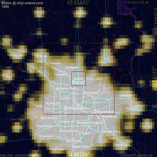
» NASA, Earths city lights 1995
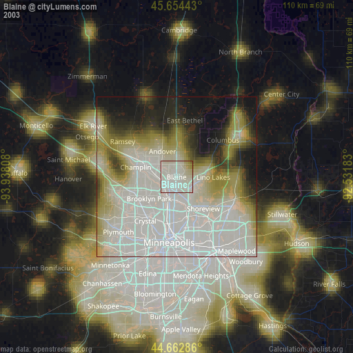
» NASA city lights 2003
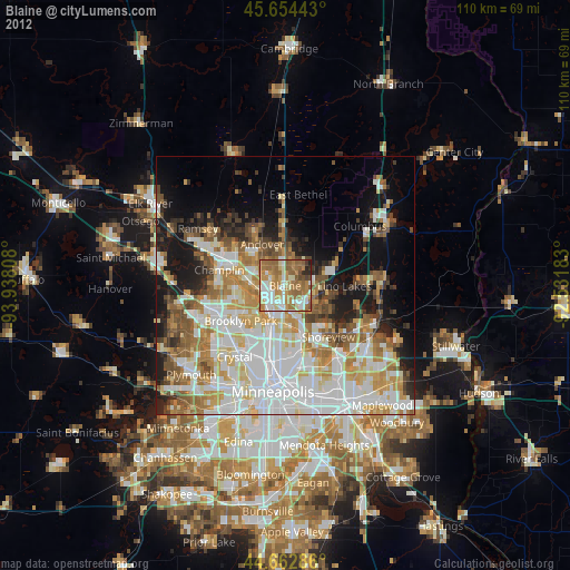
» Earth at Night: Flat Maps 2012, 2016