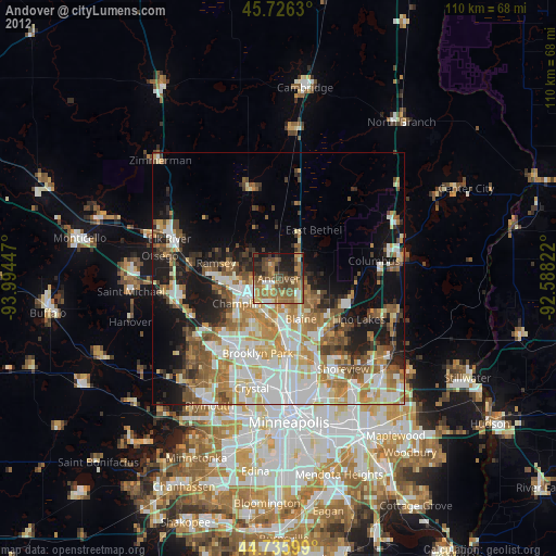
Andover night lights from space
Night Light of Andover (Minnesota) from space (United States) Src. Average luminocity for 10x10km area is 46.1667% and for 50x50km: 33.3113%.
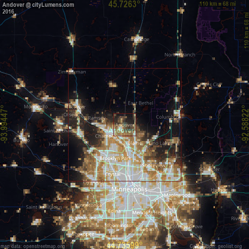
Analysis of Andover night lights 2016
Square area 10x10 km:
 3.48%
3.48%90-99
4.39%80-89
7.12%70-79
5.3%60-69
9.09%50-59
12.58%40-49
15.15%30-39
11.67%20-29
11.97%10-19
16.67%0-9
2.58%Square area 50x50 km:
7.22%90-99
6.79%80-89
3.84%70-79
4.36%60-69
5.74%50-59
4.56%40-49
4.38%30-39
3.38%20-29
5.94%10-19
10.74%0-9
43.06%Clear (daylight) street map image can be seen on geolist.org.
Map coordinates:
45° 43' 34.7" North, 93° 59' 40.1" West
45° 13' 59.9" North, 93° 17' 28.8" West
44° 44' 9.6" North, 92° 35' 17.6" West
Some cities around Andover sort by population:
• West Coon Rapids
9.4 km =5.8 mi,  209°
209°
• Coon Rapids
12.6 km =7.8 mi,  178°
178°
• Blaine
9.2 km =5.7 mi,  151°
151°
• Champlin
9.7 km =6 mi,  239°
239°
• Anoka
8.5 km =5.3 mi, 242°
• Ham Lake
3.7 km =2.3 mi,  59°
59°
• East Bethel
11.8 km =7.3 mi,  35°
35°
• Oak Grove
12.3 km =7.6 mi,  346°
346°
5016374 (p: 32,213)
Sources (retrieved 2019-11-25):
» Earth at Night: Flat Maps 2012, 2016