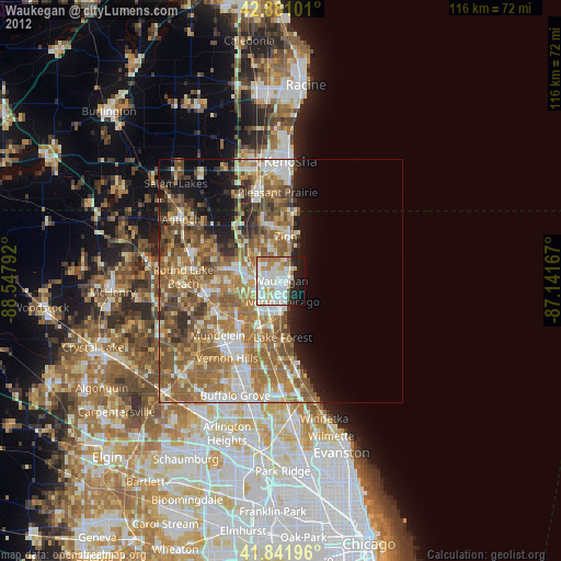
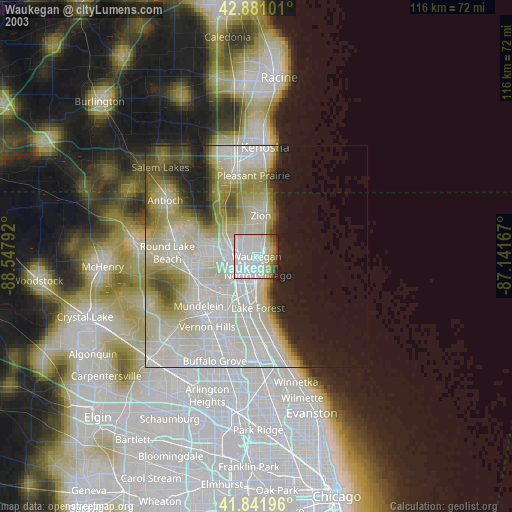
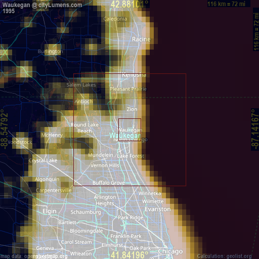
Waukegan night lights from space
Night Light of Waukegan (Illinois) from space (United States) Src. Average luminocity for 10x10km area is 70.0238% and for 50x50km: 35.4216%.
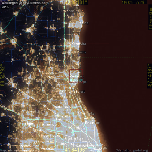
Analysis of Waukegan night lights 2016
Square area 10x10 km:
 24.44%
90-99
22.54%80-89
5.71%70-79
8.41%60-69
7.94%50-59
0.63%40-49
3.97%30-39
1.75%20-29
10.32%10-19
13.49%0-9
0.79%Square area 50x50 km:
5.21%90-99
5.69%80-89
3.93%70-79
5.04%60-69
9.05%50-59
9.37%40-49
6.2%30-39
4.22%20-29
4.95%10-19
6.43%0-9
39.9%Clear (daylight) street map image can be seen on geolist.org.
Map coordinates:
42° 52' 51.6" North, 88° 32' 52.5" West
42° 21' 49.1" North, 87° 50' 41.2" West
41° 50' 31.1" North, 87° 8' 30" West
Some cities around Waukegan sort by population:
• Gurnee
4.8 km =3 mi,  278°
278°
• North Chicago
4.2 km =2.6 mi,  175°
175°
• Zion
9.2 km =5.7 mi,  6°
6°
• Lake Forest
11.7 km =7.3 mi, 178°
• Beach Park
6.6 km =4.1 mi,  351°
351°
• Gages Lake
11.4 km =7.1 mi,  263°
263°
• Park City
3.7 km =2.3 mi,  242°
242°
• Lake Bluff
9.5 km =5.9 mi,  174°
174°
4915734 (p: 88,475)
Sources (retrieved 2019-11-25):
» NASA, Earths city lights 1995
» NASA city lights 2003
» Earth at Night: Flat Maps 2012, 2016