North Chicago night lights from space
Night Light of North Chicago (Illinois) from space (United States) Src. Average luminocity for 10x10km area is 61.8045% and for 50x50km: 37.7832%.
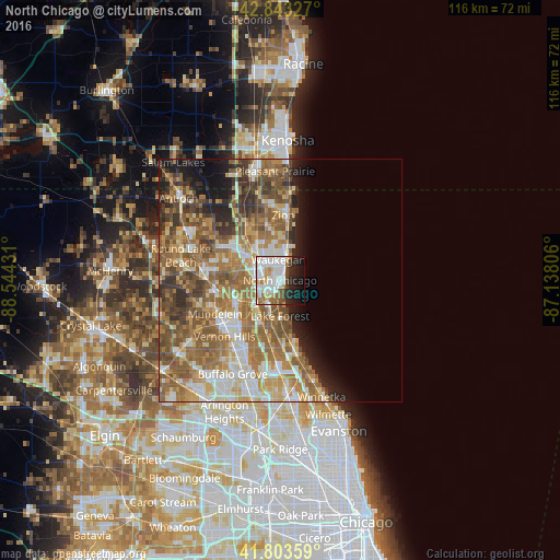
Analysis of North Chicago night lights 2016
Square area 10x10 km:
 21.06%
90-99
19.09%80-89
4.7%70-79
5%60-69
6.67%50-59
3.33%40-49
4.85%30-39
1.97%20-29
11.82%10-19
13.94%0-9
7.58%Square area 50x50 km:
5.75%90-99
6.6%80-89
4.69%70-79
5.76%60-69
9.28%50-59
9.54%40-49
5.81%30-39
4%20-29
4.54%10-19
5.9%0-9
38.13%Clear (daylight) street map image can be seen on geolist.org.
Map coordinates:
42° 50' 35.8" North, 88° 32' 39.5" West
42° 19' 32.1" North, 87° 50' 28.2" West
41° 48' 12.9" North, 87° 8' 17" West
Some cities around North Chicago sort by population:
• Waukegan
4.2 km =2.6 mi,  355°
355°
• Gurnee
7.1 km =4.4 mi,  314°
314°
• Libertyville
10.3 km =6.4 mi,  242°
242°
• Lake Forest
7.4 km =4.6 mi,  179°
179°
• Beach Park
10.8 km =6.7 mi,  352°
352°
• Gages Lake
12 km =7.5 mi,  284°
284°
• Park City
4.4 km =2.7 mi, 305°
• Lake Bluff
5.2 km =3.2 mi,  173°
173°
4903862 (p: 29,491)
Sources (retrieved 2019-11-25):
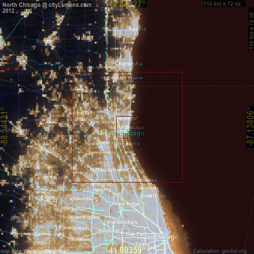
» Earth at Night: Flat Maps 2012, 2016