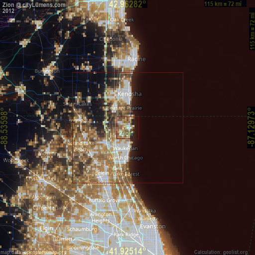
Zion night lights from space
Night Light of Zion (Illinois) from space (United States) Src. Average luminocity for 10x10km area is 49.4143% and for 50x50km: 29.2036%.
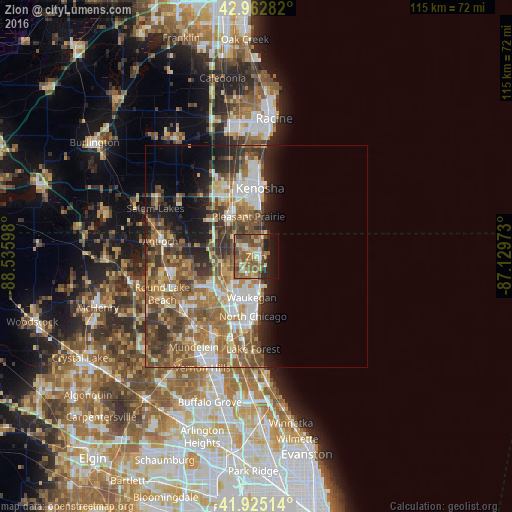
Analysis of Zion night lights 2016
Square area 10x10 km:
 3.49%
3.49%90-99
4.13%80-89
8.41%70-79
7.94%60-69
10.95%50-59
19.05%40-49
12.54%30-39
3.49%20-29
7.3%10-19
15.24%0-9
7.46%Square area 50x50 km:
4.13%90-99
4.62%80-89
3.17%70-79
4.03%60-69
6.38%50-59
6.98%40-49
5.79%30-39
4.7%20-29
5.48%10-19
6.93%0-9
47.79%Clear (daylight) street map image can be seen on geolist.org.
Map coordinates:
42° 57' 46.2" North, 88° 32' 9.5" West
42° 26' 46.1" North, 87° 49' 58.3" West
41° 55' 30.5" North, 87° 7' 47" West
Some cities around Zion sort by population:
• Waukegan
9.2 km =5.7 mi,  186°
186°
• Gurnee
10.2 km =6.3 mi,  213°
213°
• North Chicago
13.4 km =8.3 mi,  182°
182°
• Pleasant Prairie
14.5 km =9 mi,  325°
325°
• Beach Park
3.3 km =2.1 mi,  217°
217°
• Park City
11.7 km =7.3 mi,  201°
201°
• Winthrop Harbor
3.7 km =2.3 mi,  11°
11°
• Grandwood Park
13.9 km =8.6 mi,  244°
244°
4917358 (p: 24,117)
Sources (retrieved 2019-11-25):
» Earth at Night: Flat Maps 2012, 2016