Waterloo night lights from space
Night Light of Waterloo (Iowa) from space (United States) Src. Average luminocity for 10x10km area is 74.6619% and for 50x50km: 8.8993%.
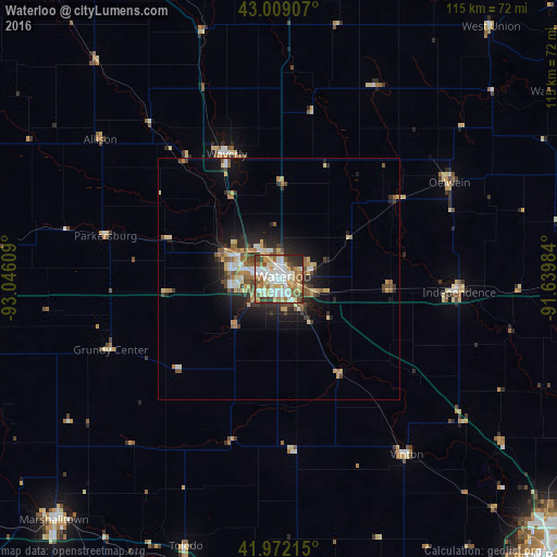
Analysis of Waterloo night lights 2016
Square area 10x10 km:
 16.98%
90-99
21.43%80-89
11.75%70-79
11.11%60-69
12.06%50-59
8.25%40-49
5.87%30-39
7.62%20-29
4.44%10-19
0.48%0-9
0%Square area 50x50 km:
1.17%90-99
1.37%80-89
1.41%70-79
1.15%60-69
1.3%50-59
1.44%40-49
1.15%30-39
1.14%20-29
2.29%10-19
5.04%0-9
82.54%Clear (daylight) street map image can be seen on geolist.org.
Map coordinates:
43° 0' 32.7" North, 93° 2' 45.9" West
42° 29' 33.9" North, 92° 20' 34.7" West
41° 58' 19.7" North, 91° 38' 23.4" West
Some cities around Waterloo sort by population:
• Cedar Falls
9.3 km =5.8 mi,  294°
294°
• Marshalltown
67.8 km =42.1 mi,  223°
223°
• Waverly
28.1 km =17.5 mi,  337°
337°
• Charles City
69.2 km =43 mi, 337°
• Oelwein
40.5 km =25.2 mi,  60°
60°
• Independence
37.3 km =23.2 mi,  94°
94°
• Vinton
44.6 km =27.7 mi,  143°
143°
• Manchester
72.8 km =45.2 mi, 90°
4880889 (p: 68,460)
Sources (retrieved 2019-11-25):
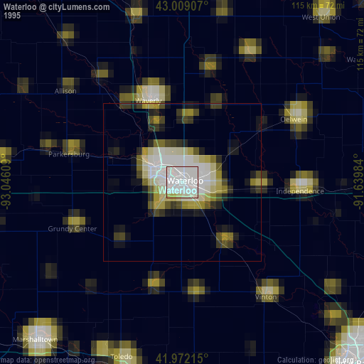
» NASA, Earths city lights 1995
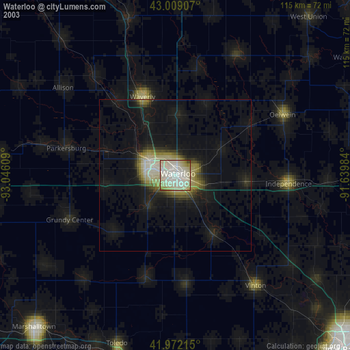
» NASA city lights 2003
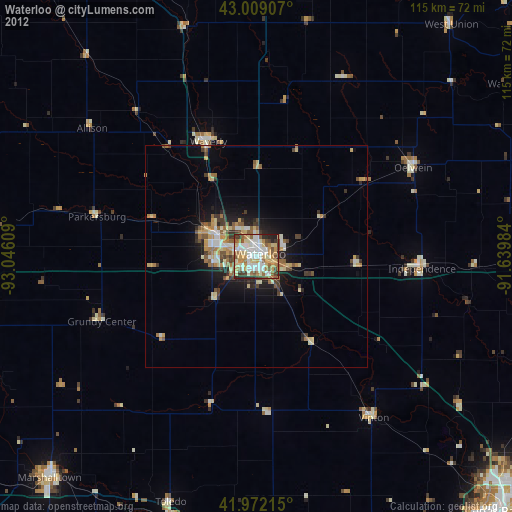
» Earth at Night: Flat Maps 2012, 2016