Vinton night lights from space
Night Light of Vinton (Iowa) from space (United States) Src. Average luminocity for 10x10km area is 8.0076% and for 50x50km: 2.4503%.
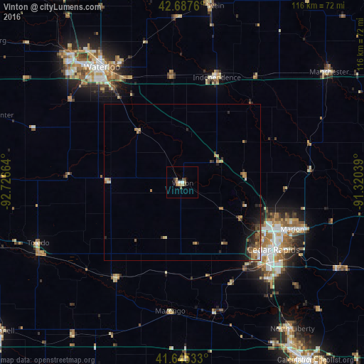
Analysis of Vinton night lights 2016
Square area 10x10 km:
 0.91%
0.91%90-99
0.91%80-89
1.21%70-79
1.21%60-69
1.82%50-59
0.76%40-49
1.21%30-39
1.06%20-29
0.3%10-19
0.3%0-9
90.3%Square area 50x50 km:
0.14%90-99
0.23%80-89
0.25%70-79
0.45%60-69
0.51%50-59
0.56%40-49
0.29%30-39
0.39%20-29
0.66%10-19
1.12%0-9
95.39%Clear (daylight) street map image can be seen on geolist.org.
Map coordinates:
42° 41' 15.4" North, 92° 43' 35.9" West
42° 10' 7" North, 92° 1' 24.6" West
41° 38' 43.2" North, 91° 19' 13.4" West
Some cities around Vinton sort by population:
• Cedar Rapids
36 km =22.4 mi,  119°
119°
• Waterloo
44.6 km =27.7 mi,  323°
323°
• Cedar Falls
52.9 km =32.9 mi, 319°
• Marion
38.2 km =23.7 mi,  113°
113°
• Hiawatha
31.8 km =19.8 mi, 117°
• Oelwein
56.8 km =35.3 mi,  9°
9°
• Independence
35.1 km =21.8 mi,  18°
18°
• Manchester
58.4 km =36.3 mi,  53°
53°
4880268 (p: 5,148)
Sources (retrieved 2019-11-25):
» Earth at Night: Flat Maps 2012, 2016