Independence night lights from space
Night Light of Independence (Iowa) from space (United States) Src. Average luminocity for 10x10km area is 14.8619% and for 50x50km: 1.7002%.
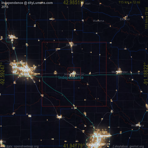
Analysis of Independence night lights 2016
Square area 10x10 km:
 0.79%
0.79%90-99
1.75%80-89
4.92%70-79
1.59%60-69
0.79%50-59
2.22%40-49
1.27%30-39
1.9%20-29
1.9%10-19
3.33%0-9
79.52%Square area 50x50 km:
0.03%90-99
0.07%80-89
0.52%70-79
0.28%60-69
0.17%50-59
0.26%40-49
0.26%30-39
0.3%20-29
0.51%10-19
0.2%0-9
97.39%Clear (daylight) street map image can be seen on geolist.org.
Map coordinates:
42° 59' 6.4" North, 92° 35' 32.9" West
42° 28' 7" North, 91° 53' 21.6" West
41° 56' 52" North, 91° 11' 10.4" West
Some cities around Independence sort by population:
• Cedar Rapids
55 km =34.2 mi,  158°
158°
• Waterloo
37.3 km =23.2 mi,  274°
274°
• Cedar Falls
46.1 km =28.6 mi,  278°
278°
• Marion
53.9 km =33.5 mi,  153°
153°
• Hiawatha
51.1 km =31.8 mi, 160°
• Oelwein
22.8 km =14.2 mi,  355°
355°
• Vinton
35.1 km =21.8 mi,  198°
198°
• Manchester
35.6 km =22.1 mi,  87°
87°
4861620 (p: 6,028)
Sources (retrieved 2019-11-25):
» Earth at Night: Flat Maps 2012, 2016