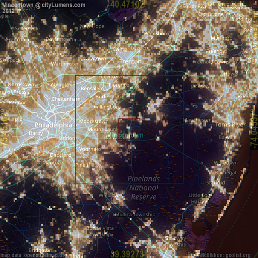
Vincentown night lights from space
Night Light of Vincentown (New Jersey) from space (United States) Src. Average luminocity for 10x10km area is 28.5442% and for 50x50km: 40.4866%.
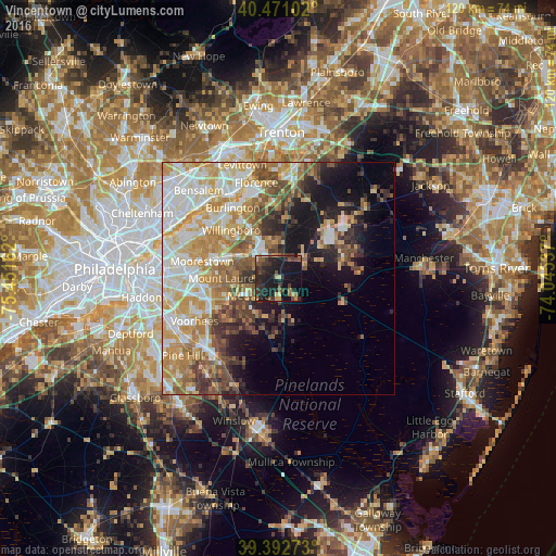
Analysis of Vincentown night lights 2016
Square area 10x10 km:
 0.17%
0.17%90-99
0.85%80-89
3.74%70-79
3.57%60-69
2.55%50-59
5.61%40-49
6.97%30-39
10.54%20-29
17.86%10-19
39.63%0-9
8.5%Square area 50x50 km:
7.45%90-99
8.1%80-89
6.94%70-79
7.7%60-69
6.1%50-59
4.84%40-49
5.16%30-39
4.27%20-29
4.88%10-19
10.64%0-9
33.93%Clear (daylight) street map image can be seen on geolist.org.
Map coordinates:
40° 28' 15.7" North, 75° 27' 5.8" West
39° 56' 2.4" North, 74° 44' 54.6" West
39° 23' 33.8" North, 74° 2' 43.3" West
Some cities around Vincentown sort by population:
• Mount Laurel
12.2 km =7.6 mi,  270°
270°
• Willingboro
14.6 km =9.1 mi,  315°
315°
• Greentree
18.1 km =11.2 mi,  256°
256°
• Browns Mills
14.7 km =9.1 mi,  73°
73°
• Mount Holly
7.3 km =4.5 mi,  332°
332°
• Marlton
15.5 km =9.6 mi,  252°
252°
• Fort Dix
15.4 km =9.6 mi,  46°
46°
• Ramblewood
16.7 km =10.4 mi, 267°
4504618 (p: 24,664)
Sources (retrieved 2019-11-25):
» Earth at Night: Flat Maps 2012, 2016