Mount Holly night lights from space
Night Light of Mount Holly (New Jersey) from space (United States) Src. Average luminocity for 10x10km area is 55.8367% and for 50x50km: 52.148%.
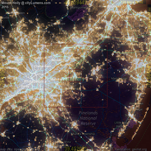
Analysis of Mount Holly night lights 2016
Square area 10x10 km:
 6.46%
6.46%90-99
7.82%80-89
6.8%70-79
5.1%60-69
15.14%50-59
19.05%40-49
10.37%30-39
10.03%20-29
12.07%10-19
7.14%0-9
0%Square area 50x50 km:
11.2%90-99
11.67%80-89
8.59%70-79
9.62%60-69
8.26%50-59
6.26%40-49
4.66%30-39
3.82%20-29
4.45%10-19
10.75%0-9
20.73%Clear (daylight) street map image can be seen on geolist.org.
Map coordinates:
40° 31' 46" North, 75° 29' 26.8" West
39° 59' 34.4" North, 74° 47' 15.6" West
39° 27' 7.5" North, 74° 5' 4.3" West
Some cities around Mount Holly sort by population:
• Willingboro
7.9 km =4.9 mi,  299°
299°
• Vincentown
7.3 km =4.5 mi,  152°
152°
• Croydon
14.4 km =8.9 mi,  316°
316°
• Burlington
10.9 km =6.8 mi, 322°
• Bristol
13.2 km =8.2 mi,  335°
335°
• Fort Dix
15 km =9.3 mi,  74°
74°
• Edgewater Park
12.8 km =8 mi,  311°
311°
• Ramblewood
15.1 km =9.4 mi,  241°
241°
4503134 (p: 10,804)
Sources (retrieved 2019-11-25):
» Earth at Night: Flat Maps 2012, 2016