Marlton night lights from space
Night Light of Marlton (New Jersey) from space (United States) Src. Average luminocity for 10x10km area is 77.6548% and for 50x50km: 59.0695%.
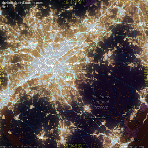
Analysis of Marlton night lights 2016
Square area 10x10 km:
 16.5%
16.5%90-99
15.65%80-89
13.27%70-79
21.94%60-69
14.63%50-59
9.52%40-49
6.8%30-39
1.7%20-29
0%10-19
0%0-9
0%Square area 50x50 km:
17.9%90-99
12.82%80-89
8.37%70-79
9.68%60-69
7.57%50-59
5.45%40-49
5.32%30-39
4.66%20-29
4.19%10-19
9.13%0-9
14.91%Clear (daylight) street map image can be seen on geolist.org.
Map coordinates:
40° 25' 42.9" North, 75° 37' 29.9" West
39° 53' 28.4" North, 74° 55' 18.6" West
39° 20' 58.6" North, 74° 13' 7.4" West
Some cities around Marlton sort by population:
• Mount Laurel
5.4 km =3.4 mi,  28°
28°
• Springdale
4 km =2.5 mi,  288°
288°
• Cherry Hill Mall
8.9 km =5.5 mi,  303°
303°
• Greentree
3 km =1.9 mi,  282°
282°
• Echelon
7.9 km =4.9 mi,  232°
232°
• Ashland
7.8 km =4.8 mi,  246°
246°
• Ramblewood
4.6 km =2.9 mi,  335°
335°
• Kingston Estates
6.7 km =4.2 mi, 302°
4502911 (p: 10,133)
Sources (retrieved 2019-11-25):
» Earth at Night: Flat Maps 2012, 2016