Greentree night lights from space
Night Light of Greentree (New Jersey) from space (United States) Src. Average luminocity for 10x10km area is 85.5612% and for 50x50km: 63.3052%.
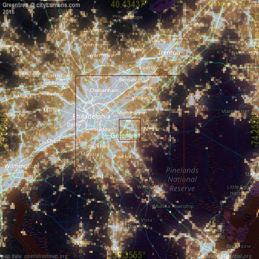
Analysis of Greentree night lights 2016
Square area 10x10 km:
 21.26%
90-99
22.28%80-89
20.92%70-79
23.98%60-69
8.33%50-59
1.36%40-49
1.19%30-39
0.68%20-29
0%10-19
0%0-9
0%Square area 50x50 km:
19.95%90-99
13.87%80-89
8.77%70-79
10.25%60-69
8.19%50-59
5.77%40-49
5.59%30-39
4.72%20-29
3.77%10-19
7.85%0-9
11.28%Clear (daylight) street map image can be seen on geolist.org.
Map coordinates:
40° 26' 3.7" North, 75° 39' 31.9" West
39° 53' 49.4" North, 74° 57' 20.6" West
39° 21' 19.8" North, 74° 15' 9.4" West
Some cities around Greentree sort by population:
• Mount Laurel
6.9 km =4.3 mi,  53°
53°
• Springdale
1.1 km =0.7 mi,  304°
304°
• Cherry Hill Mall
6.3 km =3.9 mi,  313°
313°
• Echelon
6.4 km =4 mi,  212°
212°
• Marlton
3 km =1.9 mi,  102°
102°
• Ashland
5.7 km =3.5 mi,  228°
228°
• Ramblewood
3.7 km =2.3 mi,  16°
16°
• Kingston Estates
4 km =2.5 mi,  317°
317°
4502049 (p: 11,367)
Sources (retrieved 2019-11-25):
» Earth at Night: Flat Maps 2012, 2016