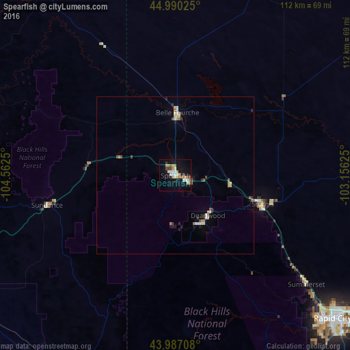
Spearfish night lights from space
Night Light of Spearfish (South Dakota) from space (United States) Src. Average luminocity for 10x10km area is 22.7413% and for 50x50km: 2.2683%.
Analysis of Spearfish night lights 2016
Square area 10x10 km:
 3.33%
3.33%90-99
3.97%80-89
1.59%70-79
3.49%60-69
5.71%50-59
1.43%40-49
2.38%30-39
1.59%20-29
0.48%10-19
21.43%0-9
54.6%Square area 50x50 km:
0.22%90-99
0.37%80-89
0.24%70-79
0.31%60-69
0.4%50-59
0.23%40-49
0.2%30-39
0.21%20-29
0.28%10-19
1.04%0-9
96.51%Clear (daylight) street map image can be seen on geolist.org.
Map coordinates:
44° 59' 24.9" North, 104° 33' 45" West
44° 29' 27" North, 103° 51' 33.7" West
43° 59' 13.5" North, 103° 9' 22.5" West
Some cities around Spearfish sort by population:
• Rapid City
67.7 km =42.1 mi,  132°
132°
• Gillette
132.4 km =82.3 mi,  260°
260°
• Box Elder
75.7 km =47 mi,  123°
123°
• Rapid Valley
74.1 km =46 mi, 129°
• Sturgis
29.2 km =18.1 mi,  107°
107°
• Douglas
228.2 km =141.8 mi,  212°
212°
• Chadron
197.2 km =122.5 mi,  159°
159°
• Belle Fourche
20.1 km =12.5 mi,  1°
1°
5769288 (p: 11,283)
Sources (retrieved 2019-11-25):
» Earth at Night: Flat Maps 2012, 2016