South El Monte night lights from space
Night Light of South El Monte (California) from space (United States) Src. Average luminocity for 10x10km area is 93.7378% and for 50x50km: 75.6652%.
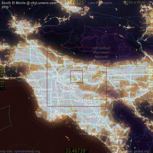
Analysis of South El Monte night lights 2016
Square area 10x10 km:
 39.16%
90-99
36.01%80-89
11.19%70-79
11.54%60-69
2.1%50-59
0%40-49
0%30-39
0%20-29
0%10-19
0%0-9
0%Square area 50x50 km:
37.13%90-99
19.12%80-89
6.2%70-79
8.45%60-69
6.64%50-59
3.25%40-49
1.75%30-39
1.21%20-29
1.77%10-19
3.48%0-9
11%Clear (daylight) street map image can be seen on geolist.org.
Map coordinates:
34° 37' 57" North, 118° 44' 59.5" West
34° 3' 7" North, 118° 2' 48.2" West
33° 28' 2.6" North, 117° 20' 37" West
Some cities around South El Monte sort by population:
• El Monte
2.6 km =1.6 mi,  43°
43°
• Montebello
7.2 km =4.5 mi,  228°
228°
• Monterey Park
7.1 km =4.4 mi,  279°
279°
• Rosemead
4 km =2.5 mi,  322°
322°
• Temple City
6.2 km =3.9 mi,  350°
350°
• West Puente Valley
7.2 km =4.5 mi,  90°
90°
• Avocado Heights
5.4 km =3.4 mi,  108°
108°
• East San Gabriel
6 km =3.7 mi, 317°
5397376 (p: 20,878)
Sources (retrieved 2019-11-25):
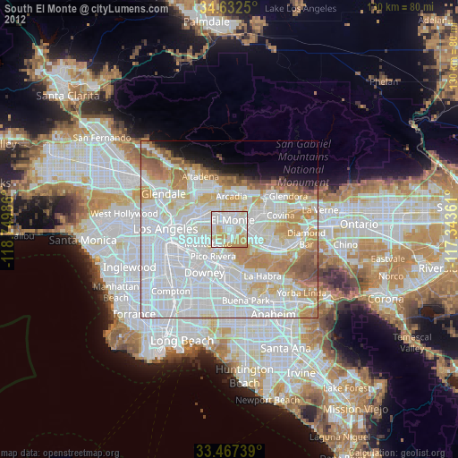
» Earth at Night: Flat Maps 2012, 2016