Rosemead night lights from space
Night Light of Rosemead (California) from space (United States) Src. Average luminocity for 10x10km area is 94.1503% and for 50x50km: 71.4118%.
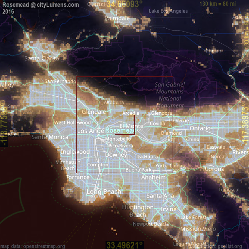
Analysis of Rosemead night lights 2016
Square area 10x10 km:
 38.29%
90-99
32.87%80-89
21.85%70-79
6.99%60-69
0%50-59
0%40-49
0%30-39
0%20-29
0%10-19
0%0-9
0%Square area 50x50 km:
36.09%90-99
16.97%80-89
5.91%70-79
7.81%60-69
6.2%50-59
3.02%40-49
1.47%30-39
1.28%20-29
1.93%10-19
3.89%0-9
15.43%Clear (daylight) street map image can be seen on geolist.org.
Map coordinates:
34° 39' 39.3" North, 118° 46' 33.5" West
34° 4' 50.1" North, 118° 4' 22.3" West
33° 29' 46.4" North, 117° 22' 11" West
Some cities around Rosemead sort by population:
• El Monte
4.4 km =2.7 mi,  107°
107°
• Alhambra
5.2 km =3.2 mi,  288°
288°
• Monterey Park
5 km =3.1 mi,  246°
246°
• San Gabriel
3.5 km =2.2 mi,  299°
299°
• Temple City
3.3 km =2.1 mi,  24°
24°
• South El Monte
4 km =2.5 mi,  142°
142°
• East San Gabriel
2.1 km =1.3 mi,  306°
306°
• South San Gabriel
4 km =2.5 mi,  209°
209°
5388867 (p: 54,908)
Sources (retrieved 2019-11-25):
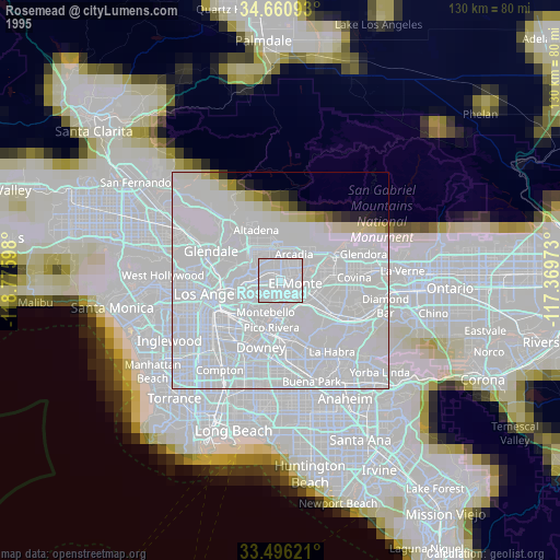
» NASA, Earths city lights 1995
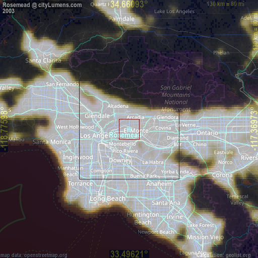
» NASA city lights 2003
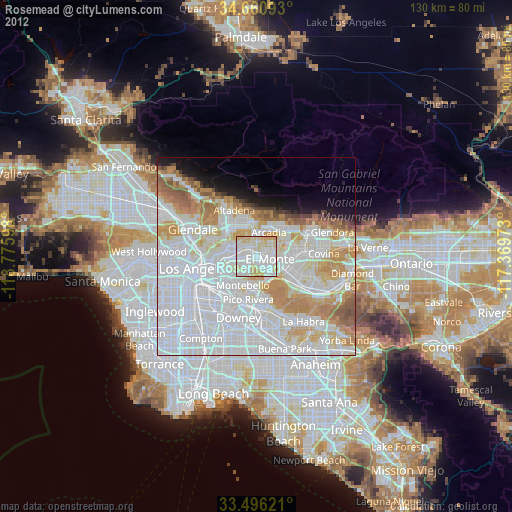
» Earth at Night: Flat Maps 2012, 2016