Monterey Park night lights from space
Night Light of Monterey Park (California) from space (United States) Src. Average luminocity for 10x10km area is 97.2133% and for 50x50km: 79.1912%.
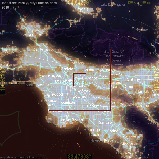
Analysis of Monterey Park night lights 2016
Square area 10x10 km:
 50.7%
50.7%90-99
39.86%80-89
6.99%70-79
2.45%60-69
0%50-59
0%40-49
0%30-39
0%20-29
0%10-19
0%0-9
0%Square area 50x50 km:
43.33%90-99
19.37%80-89
6.05%70-79
6.84%60-69
5.43%50-59
2.41%40-49
1.29%30-39
1.14%20-29
1.56%10-19
3.03%0-9
9.54%Clear (daylight) street map image can be seen on geolist.org.
Map coordinates:
34° 38' 34.8" North, 118° 49' 33.5" West
34° 3' 45" North, 118° 7' 22.3" West
33° 28' 40.9" North, 117° 25' 11" West
Some cities around Monterey Park sort by population:
• East Los Angeles
6.2 km =3.9 mi,  226°
226°
• Alhambra
3.7 km =2.3 mi,  353°
353°
• Rosemead
5 km =3.1 mi,  66°
66°
• San Gabriel
4.1 km =2.5 mi,  22°
22°
• South Pasadena
6.5 km =4 mi,  336°
336°
• East San Gabriel
4.4 km =2.7 mi,  41°
41°
• San Marino
6.7 km =4.2 mi,  12°
12°
• South San Gabriel
3 km =1.9 mi,  119°
119°
5374406 (p: 61,468)
Sources (retrieved 2019-11-25):
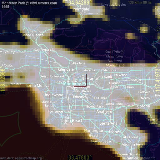
» NASA, Earths city lights 1995
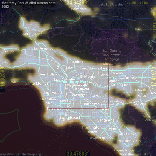
» NASA city lights 2003
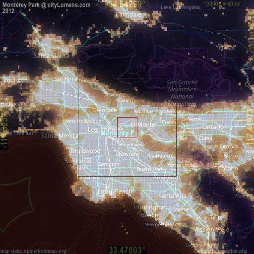
» Earth at Night: Flat Maps 2012, 2016