Silver Springs night lights from space
Night Light of Silver Springs (Florida) from space (United States) Src. Average luminocity for 10x10km area is 44.0794% and for 50x50km: 21.9802%.
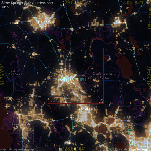
Analysis of Silver Springs night lights 2016
Square area 10x10 km:
 5.75%
5.75%90-99
6.15%80-89
3.17%70-79
4.96%60-69
20.44%50-59
5.75%40-49
4.56%30-39
3.17%20-29
11.31%10-19
21.43%0-9
13.29%Square area 50x50 km:
1.72%90-99
1.69%80-89
1.24%70-79
2.01%60-69
9.73%50-59
4.28%40-49
4.85%30-39
4.88%20-29
6.61%10-19
8.29%0-9
54.7%Clear (daylight) street map image can be seen on geolist.org.
Map coordinates:
29° 49' 42.5" North, 82° 45' 38.6" West
29° 12' 59.9" North, 82° 3' 27.3" West
28° 36' 4.1" North, 81° 21' 16.1" West
Some cities around Silver Springs sort by population:
• Ocala
8.7 km =5.4 mi,  247°
247°
• The Villages
32.8 km =20.4 mi,  163°
163°
• Leesburg
48.4 km =30.1 mi, 158°
• Lady Lake
35.7 km =22.2 mi, 158°
• Hernando
46.8 km =29.1 mi,  221°
221°
• Citrus Springs
46.9 km =29.1 mi,  238°
238°
• Wildwood
39.1 km =24.3 mi,  177°
177°
• Citra
22.3 km =13.9 mi,  346°
346°
4173002 (p: 10,334)
Sources (retrieved 2019-11-25):
» Earth at Night: Flat Maps 2012, 2016