Leesburg night lights from space
Night Light of Leesburg (Florida) from space (United States) Src. Average luminocity for 10x10km area is 52.2083% and for 50x50km: 30.0043%.
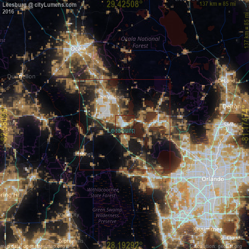
Analysis of Leesburg night lights 2016
Square area 10x10 km:
 8.33%
8.33%90-99
10.42%80-89
2.65%70-79
3.98%60-69
17.61%50-59
5.11%40-49
6.44%30-39
8.9%20-29
31.06%10-19
5.49%0-9
0%Square area 50x50 km:
2.99%90-99
3.4%80-89
1.65%70-79
2.5%60-69
10.8%50-59
4.5%40-49
5.05%30-39
7.66%20-29
10.75%10-19
17.44%0-9
33.25%Clear (daylight) street map image can be seen on geolist.org.
Map coordinates:
29° 25' 30.3" North, 82° 34' 51.6" West
28° 48' 39" North, 81° 52' 40.3" West
28° 11' 34.5" North, 81° 10' 29.1" West
Some cities around Leesburg sort by population:
• The Villages
15.9 km =9.9 mi,  329°
329°
• Eustis
19.3 km =12 mi,  76°
76°
• Tavares
14.9 km =9.3 mi,  92°
92°
• Lady Lake
12.6 km =7.8 mi,  339°
339°
• Mount Dora
22.8 km =14.2 mi, 92°
• Groveland
28.2 km =17.5 mi,  174°
174°
• Wildwood
17 km =10.6 mi,  290°
290°
• Mascotte
25.9 km =16.1 mi,  181°
181°
4161771 (p: 21,993)
Sources (retrieved 2019-11-25):
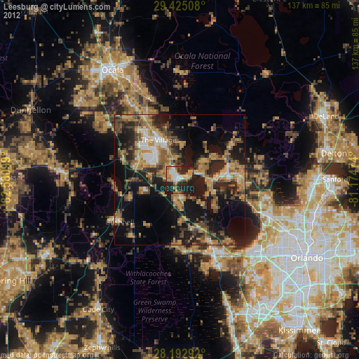
» Earth at Night: Flat Maps 2012, 2016