Citra night lights from space
Night Light of Citra (Florida) from space (United States) Src. Average luminocity for 10x10km area is 7.6875% and for 50x50km: 9.7634%.
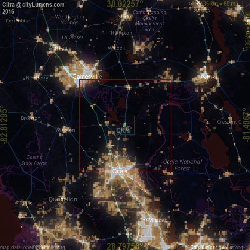
Analysis of Citra night lights 2016
Square area 10x10 km:
 0%
0%90-99
0%80-89
0%70-79
0%60-69
1.52%50-59
3.03%40-49
2.65%30-39
3.41%20-29
3.6%10-19
2.46%0-9
83.33%Square area 50x50 km:
0.88%90-99
0.86%80-89
0.34%70-79
0.77%60-69
3.56%50-59
1.46%40-49
2.2%30-39
2.57%20-29
2.67%10-19
5.13%0-9
79.56%Clear (daylight) street map image can be seen on geolist.org.
Map coordinates:
30° 1' 21.3" North, 82° 48' 46.6" West
29° 24' 42.9" North, 82° 6' 35.4" West
28° 47' 51.3" North, 81° 24' 24.1" West
Some cities around Citra sort by population:
• Gainesville
33.8 km =21 mi,  322°
322°
• Ocala
25.2 km =15.7 mi,  186°
186°
• The Villages
55.1 km =34.2 mi,  164°
164°
• Palatka
52.7 km =32.7 mi,  60°
60°
• Silver Springs
22.3 km =13.9 mi,  166°
166°
• Alachua
48.5 km =30.1 mi, 321°
• Silver Springs Shores
35.3 km =21.9 mi, 165°
• Newberry
54.7 km =34 mi,  298°
298°
4151132 (p: 5,732)
Sources (retrieved 2019-11-25):
» Earth at Night: Flat Maps 2012, 2016