The Villages night lights from space
Night Light of The Villages (Florida) from space (United States) Src. Average luminocity for 10x10km area is 80.0536% and for 50x50km: 29.9967%.
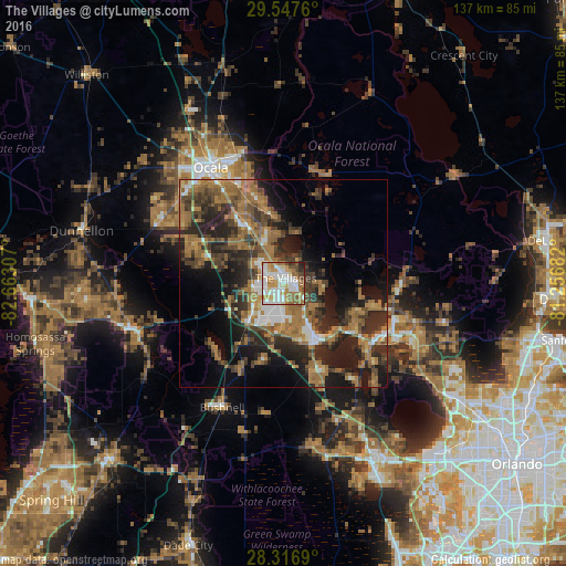
Analysis of The Villages night lights 2016
Square area 10x10 km:
 23.41%
90-99
23.41%80-89
6.35%70-79
15.08%60-69
14.68%50-59
8.73%40-49
4.56%30-39
1.19%20-29
2.38%10-19
0.2%0-9
0%Square area 50x50 km:
2.97%90-99
3.17%80-89
1.54%70-79
2.56%60-69
11.92%50-59
5.51%40-49
5.4%30-39
7%20-29
10.73%10-19
12.59%0-9
36.61%Clear (daylight) street map image can be seen on geolist.org.
Map coordinates:
29° 32' 51.4" North, 82° 39' 47.1" West
28° 56' 2.7" North, 81° 57' 35.8" West
28° 19' 0.8" North, 81° 15' 24.6" West
Some cities around The Villages sort by population:
• Ocala
33.1 km =20.6 mi,  328°
328°
• Leesburg
15.9 km =9.9 mi,  149°
149°
• Eustis
28.2 km =17.5 mi,  108°
108°
• Tavares
27 km =16.8 mi,  122°
122°
• Lady Lake
4.1 km =2.5 mi, 117°
• Silver Springs
32.8 km =20.4 mi,  343°
343°
• Wildwood
10.9 km =6.8 mi,  225°
225°
• Silver Springs Shores
19.8 km =12.3 mi, 342°
4175179 (p: 51,442)
Sources (retrieved 2019-11-25):
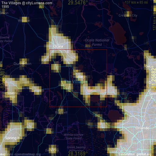
» NASA, Earths city lights 1995
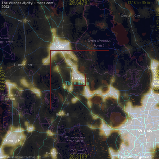
» NASA city lights 2003
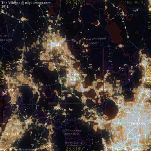
» Earth at Night: Flat Maps 2012, 2016