Shirley night lights from space
Night Light of Shirley (New York) from space (United States) Src. Average luminocity for 10x10km area is 53.4932% and for 50x50km: 25.0196%.
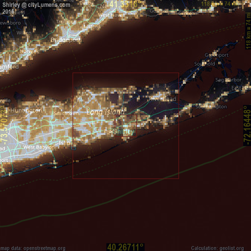

Analysis of Shirley night lights 2016
Square area 10x10 km:
 3.23%
3.23%90-99
4.08%80-89
6.46%70-79
10.54%60-69
9.69%50-59
17.52%40-49
21.26%30-39
13.61%20-29
12.24%10-19
1.36%0-9
0%Square area 50x50 km:
2.51%90-99
3.22%80-89
3.24%70-79
5.02%60-69
5.27%50-59
5.12%40-49
4.21%30-39
2.96%20-29
5.21%10-19
13.46%0-9
49.79%Clear (daylight) street map image can be seen on geolist.org.
Map coordinates:
41° 19' 53.8" North, 73° 34' 14.6" West
40° 48' 5.4" North, 72° 52' 3.4" West
40° 16' 1.6" North, 72° 9' 52.1" West
Some cities around Shirley sort by population:
• Mastic
2.2 km =1.4 mi,  88°
88°
• Mastic Beach
4.1 km =2.5 mi,  161°
161°
• Manorville
9.5 km =5.9 mi,  32°
32°
• Ridge
10.6 km =6.6 mi,  346°
346°
• North Bellport
7 km =4.3 mi,  244°
244°
• Center Moriches
6.5 km =4 mi, 91°
• Yaphank
5.7 km =3.5 mi,  313°
313°
• East Moriches
9 km =5.6 mi, 87°
5138022 (p: 27,854)
Sources (retrieved 2019-11-25):
» Earth at Night: Flat Maps 2012, 2016