Center Moriches night lights from space
Night Light of Center Moriches (New York) from space (United States) Src. Average luminocity for 10x10km area is 41.852% and for 50x50km: 20.3503%.
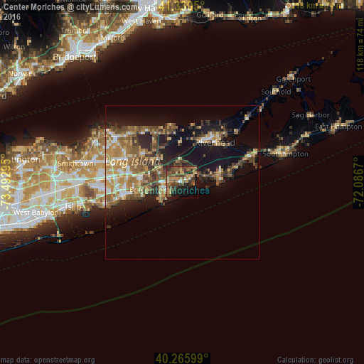
Analysis of Center Moriches night lights 2016
Square area 10x10 km:
 0.85%
0.85%90-99
2.72%80-89
5.95%70-79
6.29%60-69
11.05%50-59
12.93%40-49
14.12%30-39
8.5%20-29
8.5%10-19
19.22%0-9
9.86%Square area 50x50 km:
1.6%90-99
2.28%80-89
2.68%70-79
3.69%60-69
4.15%50-59
4.36%40-49
3.95%30-39
2.86%20-29
4.84%10-19
12.69%0-9
56.91%Clear (daylight) street map image can be seen on geolist.org.
Map coordinates:
41° 19' 49.8" North, 73° 29' 34.6" West
40° 48' 1.4" North, 72° 47' 23.4" West
40° 15' 57.6" North, 72° 5' 12.1" West
Some cities around Center Moriches sort by population:
• Shirley
6.5 km =4 mi,  271°
271°
• Mastic
4.3 km =2.7 mi, 272°
• Mastic Beach
6.4 km =4 mi,  234°
234°
• Manorville
8.3 km =5.2 mi,  349°
349°
• North Bellport
13.2 km =8.2 mi,  257°
257°
• Calverton
12.4 km =7.7 mi,  18°
18°
• Yaphank
11.4 km =7.1 mi,  290°
290°
• East Moriches
2.5 km =1.6 mi,  77°
77°
5112020 (p: 7,580)
Sources (retrieved 2019-11-25):
» Earth at Night: Flat Maps 2012, 2016