Yaphank night lights from space
Night Light of Yaphank (New York) from space (United States) Src. Average luminocity for 10x10km area is 57.102% and for 50x50km: 27.549%.
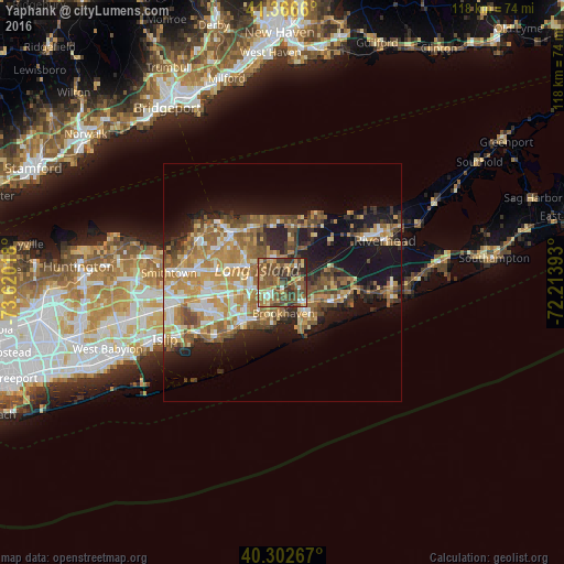
Analysis of Yaphank night lights 2016
Square area 10x10 km:
 3.74%
3.74%90-99
4.42%80-89
8.5%70-79
10.2%60-69
11.73%50-59
22.11%40-49
19.9%30-39
14.12%20-29
5.1%10-19
0.17%0-9
0%Square area 50x50 km:
3.05%90-99
3.91%80-89
3.73%70-79
5.59%60-69
5.76%50-59
5.35%40-49
4.31%30-39
3.13%20-29
5.36%10-19
13.47%0-9
46.35%Clear (daylight) street map image can be seen on geolist.org.
Map coordinates:
41° 21' 59.8" North, 73° 37' 12.6" West
40° 50' 12.4" North, 72° 55' 1.4" West
40° 18' 9.6" North, 72° 12' 50.1" West
Some cities around Yaphank sort by population:
• Coram
7.9 km =4.9 mi,  296°
296°
• Shirley
5.7 km =3.5 mi,  133°
133°
• Medford
7.3 km =4.5 mi,  253°
253°
• Mastic
7.5 km =4.7 mi,  121°
121°
• Mastic Beach
9.5 km =5.9 mi,  144°
144°
• Ridge
6.6 km =4.1 mi,  15°
15°
• North Bellport
7.3 km =4.5 mi,  197°
197°
• Middle Island
5.6 km =3.5 mi,  342°
342°
5145197 (p: 5,945)
Sources (retrieved 2019-11-25):
» Earth at Night: Flat Maps 2012, 2016