Mastic Beach night lights from space
Night Light of Mastic Beach (New York) from space (United States) Src. Average luminocity for 10x10km area is 37.789% and for 50x50km: 23.7638%.
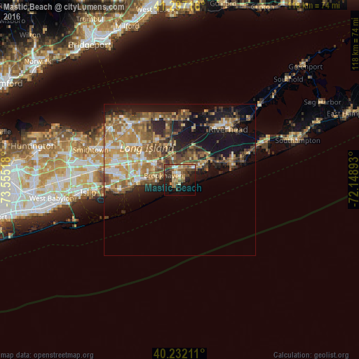
Analysis of Mastic Beach night lights 2016
Square area 10x10 km:
 2.92%
2.92%90-99
3.25%80-89
5.03%70-79
7.14%60-69
8.12%50-59
6.66%40-49
9.9%30-39
5.19%20-29
11.04%10-19
22.89%0-9
17.86%Square area 50x50 km:
2.41%90-99
3.1%80-89
3.08%70-79
4.67%60-69
4.99%50-59
4.84%40-49
3.98%30-39
2.92%20-29
5.09%10-19
13.11%0-9
51.79%Clear (daylight) street map image can be seen on geolist.org.
Map coordinates:
41° 17' 49.8" North, 73° 33' 18.6" West
40° 46' 0.4" North, 72° 51' 7.4" West
40° 13' 55.6" North, 72° 8' 56.1" West
Some cities around Mastic Beach sort by population:
• Shirley
4.1 km =2.5 mi,  341°
341°
• East Patchogue
12.1 km =7.5 mi,  270°
270°
• Manorville
12.5 km =7.8 mi,  17°
17°
• North Bellport
7.7 km =4.8 mi,  276°
276°
• Center Moriches
6.4 km =4 mi,  54°
54°
• North Patchogue
13.4 km =8.3 mi, 279°
• Yaphank
9.5 km =5.9 mi,  324°
324°
• East Moriches
8.8 km =5.5 mi,  60°
60°
5126209 (p: 14,841)
Sources (retrieved 2019-11-25):
» Earth at Night: Flat Maps 2012, 2016