Manorville night lights from space
Night Light of Manorville (New York) from space (United States) Src. Average luminocity for 10x10km area is 26.1173% and for 50x50km: 21.6849%.
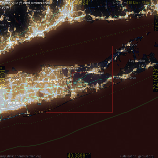
Analysis of Manorville night lights 2016
Square area 10x10 km:
 0%
0%90-99
0.68%80-89
2.04%70-79
1.36%60-69
2.72%50-59
8.67%40-49
5.1%30-39
9.18%20-29
18.71%10-19
42.69%0-9
8.84%Square area 50x50 km:
1.91%90-99
2.63%80-89
2.8%70-79
4.01%60-69
4.48%50-59
4.57%40-49
3.94%30-39
2.78%20-29
4.97%10-19
12.93%0-9
54.99%Clear (daylight) street map image can be seen on geolist.org.
Map coordinates:
41° 24' 11.7" North, 73° 30' 39.6" West
40° 52' 25.4" North, 72° 48' 28.4" West
40° 20' 23.7" North, 72° 6' 17.1" West
Some cities around Manorville sort by population:
• Shirley
9.5 km =5.9 mi,  212°
212°
• Mastic
8.4 km =5.2 mi,  199°
199°
• Ridge
7.7 km =4.8 mi,  286°
286°
• Wading River
9 km =5.6 mi,  341°
341°
• Center Moriches
8.3 km =5.2 mi,  169°
169°
• East Shoreham
9.9 km =6.2 mi,  322°
322°
• Calverton
6.5 km =4 mi,  56°
56°
• East Moriches
8.6 km =5.3 mi,  152°
152°
5125817 (p: 14,314)
Sources (retrieved 2019-11-25):
» Earth at Night: Flat Maps 2012, 2016